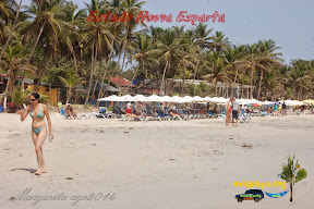
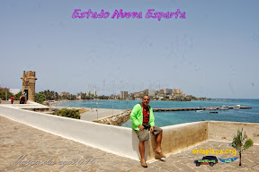
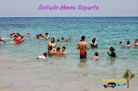
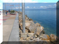
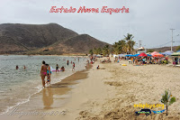
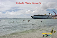
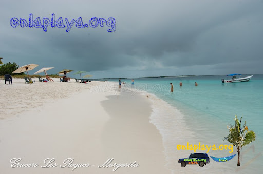
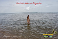
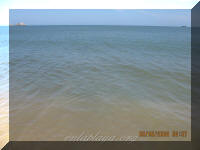
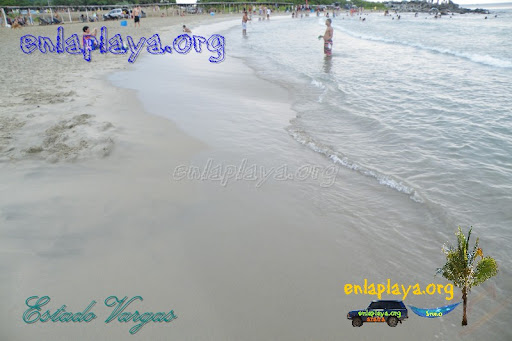
Best Beaches in Venezuela top 100

Best Beaches in Venezuela top 100

100 Best Beaches of Venezuela top100

I am making a list of the 100 best beaches in Venezuela HERE (http://enlaplaya.org/foro/viewforum.php?f=14) you can add the beaches you consider should be on that list ( ADD PLAYA ) In Venezuela there different types of beach practically to all tastes, the idea is to try that here we manage to cover all those tastes and types of beaches, when a thread is habra, people can disagree with your opinion, so we must respect the views of others and demand respect for our opinion.

VOTE FOR BEACHES WITH A PREFERENCE FOR FACEBOOK OR GOOGLE ME LIKE G, THE FINAL ENTERED THE BEACHES WITH THE MOST VOTES.


Playa El Agua NE035
 

Playa El Agua NE035

NE035 Playa El Agua, Nueva Esparta state, Antolin del Campo

Enter the Top 100 beaches Venezuela. Has 3000 meters long, with crystal clear waters, palm trees, spacious with soft sand and over 100 service offerings among shops and restaurants on the beach with all amenities, walking boulevard, travel agencies, internet, police module mall nearby. Spend the public transport ser callle Playa El Agua. Movement surfing lessons, water sports and nightlife, is called "The Beach Rumbera Margarita" is observed. Close to the beach, concluídas buildings are in process of Venezuela housing mission.
Playa Bahia de Cata Ar090
 

Playa Bahia de Cata Ar090

Bahia de Cata

Beach about 1200 meters, clear water, moderate waves, soft sand of 30 to 40 meters, is located in the area locality near, is one of the most visited beaches in the state for its breadth and variety of services, there season parking but become small and parking is a mess,

Cipara Beach (Yesto) S031
 

Cipara Beach (Yesto) S031

Cipara Beach (Yesto) S031

Linda beach about 1500 meters, in the fishing village of Cipara, deep emerald beach, practically a single wave, sand pebble ridge Millimetre, no services, arrive in the morning with fishing boats is formed, there are many sea ??grapes and coconut trees that provide shade, you can camp and ride hammocks and no pest, quite a breeze, super relaxing sound of the waves. Caribbean River at 80 km there Cipara

Playa Cuyagua Ar075
 

Playa Cuyagua Ar075


Playa Cuyagua

700m beach, clear water, strong to moderate swell depending on the area of ??the beach season, soft sand, just off the beach is an excellent river to remove salt water and cool, is located in the area locality near,

Playa Bella Vista NE006
 

Playa Bella Vista NE006


Playa Bella Vista NE006, Nueva Esparta, Margarita

Enter the TOP 100 has warm, clear waters, wide section of soft sand and grass. Presence of coconut trees that provide shade, no vehicle access, but from hotels and nearby buildings. It is very close to the hotel Bella Vista. The Top 100 refers to the 100 best beaches in Venezuela.

Playa Concorde NE008
 

Playa Concorde NE008

s

Enter the Top 100 beaches.Located at the rear of the Hotel Concorde. It has clear, warm waters, no waves, soft sand, awnings service and restaurants, parking.

Playa Vallecito S174
 

Playa Vallecito S174


Playa Vallecito S174

Beach about 120 meters, clear, warm waters, little waves, soft sand, has service restaurant, awnings, saves lives, parking, and water activities, you can go snorkeling and camping.

Playa Pampatar NE019
 

Playa Pampatar NE019

Playa Pampatar NE019, Nueva Esparta, Margarita

Enter the top 100 beaches.Beautiful bay with crystal clear water, soft sand, coconut trees, roads. It can be seen from the Castillo de San Carlos Borromeo Castle known as Pampatar. It has restaurants nearby, all services, colonial area church. Located on Calle La Marina Pampatar. It is difficult to park.

Playa Pantaleta V047
 

Playa Pantaleta V047

Playa Pantaleta V047

One of the most organized beaches of Vargas, is about 250 feet, soft sand, clear water, tents, restaurants, Civil Protection, baths and showers, shops, public transport to La Guaira, playground, place of medical care, since the Police Vargas, gravel parking lot and also beach access for vehicles. It is reached by the coast road, after passing Playa Los Angeles.

Playa La Barge S151
 

Playa La Barge S151

Playa La Barge S151This beach is about 100 meters long, 10 meters of soft sand, crystal clear water pool type. It has bathing facilities and restaurant in high season only.The name of the barge, according to locals, is derived from a boat carrying water Puerto la Cruz to Margarita which was damaged, being sunk in the area.
Playa Juventud NE020
 

Playa Juventud NE020

Playa Juventud NE020, Nueva Esparta state, Margarita

Beach with clear, warm and calm waters, soft sand, where they dock diving, you can dive.It is difficult to park. You enter through a street kiosk on both sides. Located near Av. Antonio Diaz, Street May 3. For its clear, calm waters, this beach comes in the top 100 of Venezuela, top100

Playa Los Angeles "A" V050
 

Playa Los Angeles "A" V050

Playa Los Angeles A V050

This sector is comprised of a group of beaches to F all have similar characteristics just have different inputs,

This beach is about 200 meters, clear water, warm, moderate swell ,, for its easy access and variety of services this beach is among the best beaches in Venezuela 100, top100

Playa Cangrejo An036
 

Playa Cangrejo An036

Playa Cangrejo An036It is a beach of 1500 meters, 20 meters of sand. Calm and shallow waters. They are rescuing the boulevard to the beach and restaurants making possible constructions near her in the sand (Jun09). Playa Los Canales, Lido, The Virgin and Crab is one beach that is renamed by sector and location of a "boardwalk". Is reached by road and is located at Av. Dairy Beach.
Playa Maigualida S137
 

Playa Maigualida S137

Playa Maigualida S137

Beach about 120 meters, no waves, murky water, gravel, has several coconut trees. Very close to the beach is the Hotel Maigualida. Under the Sea is located one hut. Small beach for its beauty and tanquilida 100 is among the best beaches in Venezuela, top100

San Antonio del Golfo (Diving) S131
 

San Antonio del Golfo (Diving) S131

San Antonio del Golfo (Diving) S131Beach located next to Playpen, near a large roads, clear and deep waters, used for diving.As a super special place for snorkeling where you can literally off the car take two steps, and be 10, 20, 30 meters, this place is among the 100 best beaches in Venezuela, top100

Playa La Galera NE060
 

Playa La Galera NE060

Playa La Galera, Nueva Esparta State, County Marcano, top100

Enter the Top 100 Beaches Venezuela. Extensive beach, shaped bay, clear water, no waves (ideal for families with small # or # os os), soft sand, tents, chairs, restaurants nearby. Parallel to the beach there is a street where cars are allowed.Close to Fort La Galera, from which there is a side of Juan Griego and La Galera Other Side has a small # a cafe inside, and selling souvenirs. Ideal for taking pictures of the bay and the town. It is famous for its beautiful sunsets.

Playa Paraiso, (La Punta) NE126
 

Playa Paraiso NE126

Playa Paraiso NE126 (The Point), Nueva Esparta State, Tubores

Playa entering the top 100 beaches in Venezuela to present calm, clear waters, white sand, restaurants. The entrance is through the International Port The Guamanche. From the beach you can see the ships coming into port. Access users is until 2:30 pm and has several rules that can be observed at the end of the pictures.

Playa Parguito NE034
 

Playa Parguito NE034

Playa Parguito NE034, Nueva Esparta State, Antolin del Campo

Enter the Top 100 beaches. Is 1600 mts wide, soft sand, clear water, in times of strong breeze the surf is moderate, restaurants on the beach, some with baths and showers, awnings. Something very strange is that the same people doing business on the beach, protect turtle nests in the sand. The wide range of amenities and the beach and wide area makes it into the top 100 beaches in Venezuela.
Playa El Indio M115
 

Playa El Indio M115

Playa El Indio Estado Miranda

Beach about 70 meters of crystal clear water, no waves, soft sand, is reached by taking a small boat from chuspa in high season runs a small food kiosk, vehicles left in the parking chuspa.

Playa Crasqui DF039
 

Playa Crasqui DF039

Playa Los Roques Crasqui DF039

Key about 6000 meters from pristine beaches, soft sand, little waves, it gets deep slowly, no services, there is little natural shade so you have to cum prepared and very careful of the sun,

Playa Caribe M117
 

Playa Caribe M117

Playa Caribe M117 Miranda state

It is ranked 65th in my list of best beaches in Venezuela 100

Beach about 200 meters, clear waters, no waves, bellisimos corals, super soft sand, you can snorkel and camp, arriving by boat from chuspa, there are kiosks where to eat and buy some stuff, rent chairs and awnings, has a unique natural pool. The Cooperative "Virgen del Rosario" kindly gave us the line to take photographs of the beaches. .

Playa Puerto Frances M090
 

Playa Puerto Frances M090

Playa Puerto Frances M090

Beach 400m having 5 to 15 meters of sand, calm clear waters swell to moderate depending on the time, a section of the beach is soft sand and the water gets deeper slowly, another part of the beach has a bedrock has little natural shade, services awning, chairs, restaurant, beach gear sales, lifeguard and first aid, ample parking for vehicles and buses.

Playa Blanca S154
 

Playa Blanca S154

Playa Blanca S154

It is a beach 120 meters long, crystal clear pool type, 20 meters of gravel. It owes its name to the white sand. One of the most visited beaches in the park throughout the year, recommended for children, suitable for diving by the number of fish observed.

Playa Arapito S175
 

Playa Arapito S175


Playa Arapito S175400 meters beach, very popular with its easy access to roadside Puerto La Cruz (25min) - Cumana (35min), clear, warm waters, no waves, soft sand, ample parking, all services and some water activities , bathrooms, saves lives, awnings restaurants, very safe family beach.
Playa Araya (El Castillo) S108
 

Playa Araya (El Castillo) S108

One of the Top Ten Beaches

Playa Araya (El Castillo) S108

250 meters beach, soft white sand, clear waters and no waves. Shallow, there are all services. Near the remains of a castle Highly recommended. is in the Top100 of the beaches of Venezuela, unfortunately are growing the rancherias and anarchy in this beach

Playa Paraiso V022 4x4
 

Playa Paraiso V022 4x4


Playa Paraiso V022 4x4Beach about 280 meters, clear waters of moderate to strong waves, soft sand, is more popular than the beach itself, for its difficult access makes it an adventure for 4x4 lovers, little natural shade, access is free but put a guaya that blocks access and call a collaboration. (No need to pay). This Playa enters the top100 as a courtesy to the 4x4 world because although the beach is not good if the atmosphere is unsurpassed 4x4
Complejo Turistico Cachamaure S132
 

Balneareo Cachamaure S132

Balneareo Cachamaure S132200 mts beach without sand, clear, deep waters. It caminerias, green areas for play and rest, parking, has rooms with 4 people to rent. All services, you can camp. Worth a visit. Spa Cachamaure, for its clear, calm water and the warmth of the complex, enters the top 100 beaches in Venezuela, top100

Playa Manare S155
 

Playa Manare S155

Playa Manare S155250 meters beach, crystal clear and calm waters, shallow, soft sand. It has some restaurant services only in peak periods.Is reached by taking a boat or small boat from the main port of Mochima. The tour lasts 25 min. approx. The calm waters make cistalinas and be among the top 100 beaches Venezuela, top100

Playa M111 Mono Manso
 

Manso M111 Mono Beach Nude Beach

Playa M111 Mono Manso

130 meters beach, crystal clear water, no waves, soft sand and pebble millimeter, so far used to practice the "nudity", besides you can camp and snorkeling, there is any kind of service, natural shade is reached taking a small boat from chuspa. Being a beach with calm and crystal clear waters, and so irformal be reserved to the practice of this beach Nudism enters the top 100 of Venezuela, top100

Playa Conoma AN005
 

Playa Conoma AN005

Playa Conoma AN005It is a beach 350 meters, 15 meters of sand, clear and calm waters. It has restaurants, restrooms and present the tourist police. It has ample parking. It is located 15 minutes from the national highway. This beach comes among the top 100 beaches in Venezuela for its clear, calm waters, top100
Playa Los Totumos M086
 

Playa Los Totumos M086

Playa Los Totumos M086Beach 500 meters, and 20 to 30 feet of sand, clear or turbid water depending on the time, coarse sand, services awning, chairs, restaurant, beach gear sales, lifeguard and first aid, ample parking of vehicles and buses . Its easy access, clear, warm waters, and its range of services make it among the best beaches in Venezuela, but playing against the low water circulation which makes it prone to contamination, top100
Playa Pui Pui S040
 

Playa Pui Pui S040

Playa Pui Pui S040

Extensive beach of over 1200 meters, coconut trees where sun protection, moderate waves with surf, clear water, beach directly exposed to the ocean, soft sand, has a hotel, restaurant, houses for rent, you can camp, the road to get is in good condition.Although the water is cold and surf, this beach comes from the best of Venezuela, for its large areas of sand and shaded by coconut top100

Playa Colada M051
 

Playa Colada M051

Playa Colada M051Hundreds and hundreds of meters from the beach, 50 meters of sand, water warm, cloudy and moderate swell temperature. Services awnings, chairs, food kiosks. Lifeguard in season. It has services distraction as engine glider season. Its easy access and wide range of services make it be among Best Beaches of Venezuela, top100
Playa Boca de Palo NE120
 

Playa Boca de Palo NE120

Playa Boca de Palo NE120, Nueva Esparta State, Tubores

This Playa enters the top100for their special features deepwater and downs, has an area of over 50000 m2 of water between 30 and 50 cm ideal to put a table on the water and enjoy soaking your feet or depth to let the kids play with RC boat safely because water has no waves, quiet and petite. It is located within the Monument Natural Tits Maria Guevara.

Playa La Cueva V025 (Urama)
 

Playa La Cueva V025 (Urama)

Playa La Cueva V025 (Urama)

Playa reach 50 meters walk from the beach Urama, through a cave, which depending on the time and tide may or may not go through, this cave is one of the best kept secrets in this area beaches, crystal clear waters, without waves, warm, no services is an oasis next to a busy beach.

Playa Madrizqui DF008
 

Playa Los Roques Madrisqui DF008

Playa Madrizqui DF008

The Cayo Madrizqui is a 5 minute boat ride from Gran Roque in Los Roques National Park, the key has a perimeter of about 2000 meters of which about 1200 are pristine beaches. no waves, soft white sands, and other low cristlinas waters and mangroves

Sandy Querepare S021
 

Sandy Querepare S021

Playa Querepare

Linda beach about 1000 meters, clear water. moderate waves, soft sand, rental cottages on the edge of the beach, pretty shade of trees and coconut palms

Playa Noronquises DF042
 

Playa Noronquises DF042

Playa Los Roques Noronquises DF042

Key with a perimeter of 1700 meters of crystal clear water, no waves, white, soft sand, boats and pose katamaranes gently to the shore, the beach gets deep very slowly, is surrounded by sand banks, so that water has a very pleasant temperature,

Playa Colorada s172
 

Playa Colorada S172


Playa Colorada s172

250 meters beach gets its name from its red sand, clear water, no waves, warm gets deep gradually, very busy due to its easy access and ample parking, services, and some water activities.

Playa Quetepe S144
 

Playa Quetepe S144

Playa Quetepe S144

Clear water beach, thick and soft sand, has ample parking, has restaurant services.

Playa La Cienaga AR117
 

Playa La Cienaga AR117

Playa La Cienaga, Ocumare Sector Costa, AraguaIt's a whole sector Beach, white sand, no waves, excellent for diving and snorkeling clear waters of a spectacular turquoise, is reached by taking a small boat in the eastern part of Boca ocumare, travel about 12 minutes

Playa Medina S042
 

Playa Medina S042

Playa Medina S042

Beach 400 meters with all services, clear waters, few waves, shallow, soft sand, ideal for family to come without worrying about anything, large areas of grass, parking cars in the world more beautiful, cabins for rent at the seashore, highly controlled and privatized, an obnoxious sign indicating that you can not camp, makes her beauty even though not one of my favorite beaches.

Playa Las Marietas S153
 

Playa Las Marietas S153

Playa Las Marietas S153

Beach about 120 meters, 20 meters white, coarse sand.Crystal clear water pool type.One of the beaches Mochima most visited throughout the year, recommended for children. It has a small pier where people used to "throw" the water.

Playa San Luis S146
 

Playa San Luis S146

Playa San Luis S146

Giant beach, clear water, soft sand, coconut trees, have all the comforts and many hotels nearby, you are in Cumana. For its size, large extensions of sand and services, this beach is among the best 100 beaches Venezuela, top100

Playa Chirimena M099
 

Playa Chirimena M099

Playa Chirimena M099

Great beach approx 400 mtr.turbid water, coarse sand and moderate waves. Depending on the time of year, there are food stalls, tents and chairs. It has parking area. There are some houses for rent and hotels near the place, Its easy access, clear waters, and location make it among the top 100 being Playas de Venezuela, top100

Playa Pin S070
 

Playa Pin S070

Playa Pin S070300 meters beach, clear water without waves, soft sand, renting of tents, restaurants, parking, Your Clear and calm waters and easy access make it to be among the best beaches in Venezuela 100 top100
Playa Punta Colorada S109
 

Playa Punta Colorada S109

Playa Punta Colorada S109Beach 300 mts, clear, shallow waters. It has a great view from the upper parts (hills), this shame that so many shacks on the edge of the beach. It's a waste to have the beach in this state since the water is beautiful. The local authorities and must do their part and do something that can not continue spreading ranches. This beach comes from the best beaches of Venezuela in its own right, but the surroundings are about to remove the top100

V033 Fish Beach (Los Caracas)
 

V033 Fish Beach (Los Caracas)

V033 Fish Beach (Los Caracas)

Beach 400m clear, warm waters, soft sand moderate swell service, chairs, tents, restaurant, shops. The river flows next to the beach. For its easy access, variety of services and their gigantic camping spot, this beach is among the 100 best in Venezuela, top100

Playa Todasana V029
 

Playa Todasana V029

Playa Todasana V029

Beach 400 meters, has clear water kiosks, service tents and chairs, Todasana river flows right next door, forming a lagoon, low flow is therefore not cloud the water and provide fresh water, but much colder than the sea, there is a Escuala surf, beginners are taught on the river and the most advanced in the sea. For your Easy Access and variety of services, this beach is among the 100 Best Beaches of Venezuela, top100

Playa Punta Arenas NE100
 

Playa Punta Arenas NE100

Playa Punta Arenas NE100, Nueva Esparta State, Macanao

This beach enters the top100for its wide sandy area which makes it ideal for sports arena.It has very little surf, soft sand, presence of service tents and chairs at the ends, restaurant, extensive walking and sports such as volleyball, beach soccer and others. The car comes ashore.

Playa El Yaque NE133
 

Playa El Yaque NE133

Playa El Yaque NE133, Nueva Esparta State, Tubores, top100

Although it is one of the best places in the world for wind sports in the water at this time (August 2014) there was no candle in the water ... no wind ... and the water was becoming quiet no waves.

This beach is among the top 100 hotels in Venezuela,because when you breeze is ideal for water sports like surfing, skite surfing, sailing ... among others.


Los Roques Beaches

BEACHES OF ROQUES


THE Los Roques


SUPPORT ME IF SOMEONE "WITHOUT COMPROMISE" FOTOGRAFIARE these beaches that deserve special attention, WHILE STILL BRINGING MONEY TO DO IT ON MY OWN, AND SOMETHING THAT IS EXPENSIVE AND I DO NOT ACCEPT ANY TYPE OF SPONSORSHIP TO COMPROMISE THE SITE.


YOUR HISTORY

In order to protect the ecosystems in the archipelago of Los Roques and establish a rational and limited natural resources, the Venezuelan government declared it a National Park on August 8, 1972. at the same time be provided and tribute to the centennial of the creation of the world's first National Park, Yellowstone, United States.


In considering the largest marine park in Latin America, with an extension of 36 km and 26.6 km north-south. Consisting of 42 keys (islands formed by coral reefs), is located 176 km north north of the city of Caracas, about 160 of La Guaira.


Undoubtedly Los Roques is one of the most beautiful natural areas of Venezuela. Birds abound: more than 92 species are available in the archipelago, 50 of which are migratory in North America.


The mangrove vegetation is red, white, black, buttonwood fish, purslane, and burdock saladillo boleo. While the park does not exist variety of terrestrial, but some are as exotic as the tree iguanas and lizards. The reefs are the main ecosystem with a great marine diversity which abounds in many varieties of fish and corals (the park owns 98% of coral species in the world), including sea fans, brain coral and fire coral. Also the lobster (which can only be caught from November to April) and botutos (currently closed) find an ideal habitat in Los Roques, main lobster production in the country. All these data confirm the enormous wealth that holds the waters of this archipelago, which Christopher Columbus described as "heaven on earth."


THE BEACHES OF THE ARCHIPELAGO


The archipelago of Los Roques is comprised of more than 300 sand banks and numerous reefs and coral reefs in clear turquoise waters. They have a management plan and regulations according to which applications are divided into seven zones: the recreation of managed natural environment, the primitive marine, comprehensive protection of historical, cultural, archaeological and paleontological heritage of services, and special use. Some of them are for tourism and related activities, other uses are restricted and to visit a special permit is required INPARQUES, this in order to protect the fauna and flora.


The beaches of Los Roques are places of dreams, where the waters warm and clear through multiple shades of blue, from almost white on the shore to the very dark in the deep sea change that is possible to see even from short distances (100 th 200 meters .) All the islands are barren, white sand generally devoid of vegetation due to both high temperatures, which average 28 ° C, as the low annual rainfall (the occasional rains occur during a short season matches September to January). Some cays have tourist facilities such as restaurants, health and schools of windsurfing and kiteboarding. Although the actual size of the islets regulates the volume of tourists that can accept each of them, closer to the coast are undoubtedly the favorites of vacationers, so far recommend if you are looking for absolute peace and loneliness.


Here are the most visited cays called playground.


FRANCISQUI


Here are grouped three keys: Francisquí Up, Down Francisquí Middle Francisquí are the most visited due to its proximity to Gran Roque, just 10 minutes by boat. Its main attractions are the beautiful white sand beaches, particularly the Middle Francisquí south where the sea is flat calm. East of this island group is the swimming pool, a natural lake of about 6 meters deep with sandy bottom, ideal for snorkeling. The three islands form a peaceful turquoise lagoon is a great place for the anchoring of boats and yachts. Middle Francisquí has a pleasant restaurant offers fish, octopus and lobster.

Madrizqui AND KEY PIRATA


http://enlaplaya.org/foro

Venezuela Social Forum
This is the main space of the Forum to express your views on the beaches of Venezuela

The 10 best beaches in Venezuela
In your opinion what are the 10 best beaches in the country

Guia de Playas de Venezuela by State
Comment on the beaches you know in the respective states, inns and persons providing services on the beaches, they can publish their details here.

Beach community
This section is specifically dedicated as a meeting point for people who have specific interests in various beach activities, Camping, Naturism, diving, surfing, windsurfing, and any other activity that requested me to open.

OPEN FORUM (TEMPORARY)
In this forum you can post without registarte, you can leave comments fast, but I recommend that you register so you can post in all forums, this part of the forum will be deleted when finished photographing the beaches in all states or when the number of registered warrants it.


Located about five minutes southeast of Gran Roque, Madrizqui is one of the few keys that have private houses built before the archipelago was declared a national park. On its west side is a beautiful area with warm water and calm. A bank of sand between Madrizqui and fell walking Pirate allowed to pass from one island to another. Between November and April fell Plata receives the fishermen who come mainly from Margarita to the lobster fishing season, at the time, every Thursday at noon you can see fish and shellfish shipping.


Noronquises


25 minutes from Gran Roque are the three islands Noroquises usually very lonely. Noronquí Up, which has the advantage of the wreck of a sunken warship; Noronquí del Medio, the longest, and Noronquí Down, with the camp Gazebo, shelter teak Roquevé belonging to the inn. When guests of the inn are not on the beach you can enjoy these facilities.


GRASQUI


This island of about 20 minutes from Gran Roque, has the largest formation of mollusk called queen conch throughout the Caribbean. In its beautiful beach, which stretches across the west side of cay find catering services and rental of kayaks and windsurfing. It is possible to camp on the key with permission of INPARQUES.


THE KEYS OF THE PRIMITIVE AREA MARINA


To go to the beautiful beaches of the cays that make up this area of restricted and therefore limited number of visitors, you need a permit to INPARQUES, which is issued free of charge at the offices of the institution in Great Roque. The following are some of the islands most important primitive marine area.


Carenero


Located 30 minutes from Gran Roque, this large cay offered as a beautiful lake level peculiarities found in the north of the island and where you can snorkel. It has a small restaurant.


Water Cay


Located just 50 minutes from Gran Roque, is without doubt the most beautiful of the archipelago fell. It is a lonely island, dominated by the lighthouse west of Punta de Cocos, with beaches, restful dreams. It has no tourist infrastructure.


Two Mosquises


These two keys Mosquises North, the more lonely and without infrastructure, and Two Mosquises South. The latter is the Marine Biological Station, part of the Civil Científica Los Roques, where they do a captive breeding of four species of turtles that inhabit the archipelago: cactus turtle, hawksbill, loggerhead and green. His program also focuses on education, with the aim of raising new generations about the danger of extinction of species. This island is likewise a ranger station, a few bungalows for use by members of the Foundation and a private runway is also owned by the Foundation. Although South Mosquises Two has a quiet, sandy beach, in general the visits are related to the Marine Biological Station.


GRAN ROQUE


On the main island of the archipelago, with 3.5 km long and 1 km wide. It has a picturesque town of colorful houses and a runway. Unlike the other islands, Gran Roque is not full, its highest point, 110 m, is marked by an old Dutch lighthouse from which a superb view over the archipelago. In Los Roques are not big chains, but Gran Roque gives you everything you need to enjoy the park and lodging: more than 60 of the beautiful homes on this island has been converted into inns without losing its rustic particular, cover a wide range of possibilities in terms of types of services and prices. The simplest are the Posadas Los Roques, family houses where visitors are received with love and care. Then there is a good choice of inns standard level and higher. In general the service provided are excellent and complete. It is also possible to rent a beautiful cabin on a sailboat, an option reserved for adventurers willing to pay as much as one of the better hotels. Some keys provide the opportunity to camp, in this case is essential to have the authorization to Inparques.

Margarita Beaches

BEACHES Nueva Esparta State (Margarita Island)


IN THE NEXT MONTH AND PHOTOS WILL BE VISITING THE ISLAND OF MARGARITA, AND YOUR CAR AND BEACHES CUBAGUA


YOUR HISTORY


Nueva Esparta, Venezuela's only island state to 38 miles north of the mainland, is composed of three islands: Coche and Margarita Cubagua. Has an area of 1,150 km2 and more than 375,000 inhabitants. Its main economic activities are fishing and tourism. Margarita is a major tourist development of the country. La Asuncion is the capital of the state geopolitics, however, most commercial and social activity takes place in Porlamar, the main urban center of the island.


Nueva Esparta State was first designated by that name for Simón Bolívar, on May 12, 1817, comparing the courage of the people Margarita with the inhabitants of the Greek Sparta, thus paying tribute to his heroism during the War Independence. Sparta is the voice of Greek origin which was called the ancient city of Sparta, in the Peloponnese. Sparta is also a kind of broom used for braiding ropes.


As a free port and its economic development is mainly focused on trade, fishing and tourism. Its numerous natural monuments, large hotels, modern avenues, shops, restaurants, casinos and an array of exciting nightlife attracts visitors from all latitudes.


STATE BEACHES

Margarita has 315 km of coastline, of which 93 are beaches which generally offer a large amount of services and sports and recreational activities. The eastern and northern beaches, calm waters, invite you to rest, while Macanao Peninsula are lonely places, largely underserved, where visitors can have a rest and spiritual body. All hotels in Margarita located on the coast, like the Hilton, the Dunes Beach Resort, or the Hesperia Isla Bonita, among others, have beautiful beaches, lush greenery and extensive list of services, are open to the public, respecting the Regulation of the hotel.


Playa El Yaque

Located near the airport Santiago Mariño, Venezuelan beach is the best-known internationally for its ideal conditions for windsurfing and kitesurfng. The world's best practitioners of these sports are trained for several months a year on this beach of 500 mx 30 m which gives ideal conditions: white sand washed by calm shallow water where the wind blows consistently almost 365 days a year. The beach is clean and well maintained, tourist services are complete and even offer lessons in windsurfing and kite surfing for the more daring. Weekends and particularly on Sunday the beach is visited, we recommend avoiding those days. To discover.


PORLAMAR

This city, considered the island's commercial capital, was founded in 1536 under the name of Puerto de la Mar, which became over time in Porlamar. The city center is characterized by its narrow streets filled with shops on both sides. There get the best prices. In this city are the most famous avenues, its elegant shops and nightlife, Santiago Mariño and 4 de Mayo. To the east, there is now broad modern avenues and residential areas.


VALDES BEACH

Located in Porlamar, after the beach the conch, next to the fishermen's association Puerto Valdés, this is a beautiful bay (250 mx 25 m) of calm waters where fishermen moor their boats. Its white sand and clear calm waters invite relaxation. As no vegetation is recommended to take umbrella and sunscreen. In high season we get vendors offering food. You can park your car without problems and without losing sight. Be sure to visit this beautiful beach.


THE SHELL BEACH

Located on Av. Bolivar Porlamar is the main beach in town and meeting place for those who go out jogging, bike riding or weight lifting. It is a narrow strip of white sand over 1 km x 15 m that offers clear, shallow water. It has coconut trees are not enough shade. In general the area is clean and well maintained and easy to park their vehicles along the beach without losing sight. This beach is so large that it feels bathers, but the only drawback is its lack of tourist services.


MORENO BEACH

Located in the sector before Pampatar Varadero beach, Moreno is named after a sailor of the same surname whose boat sank and ended up coming to this shore clinging to a piece of wood. This is a lovely white sand beach (100 mx 35 m), in the midst of extremely arid area and sparse vegetation, where only found some small Uveros. The sea, turquoise blue, is flat and moderate swell. The beach has no tourist facilities and parking is difficult, since there is no parking and vehicles must be left in the main street or sidewalk, which is very uncomfortable and dangerous for traffic, plus it can not be monitored from the beach.


PLAYA EL ANGEL

It is just after Moreno beach in Varadero sector. Its name comes from the shape of angel with the rock on the right of the beach, considered a freak of nature for the residents of the island. The beach is a pleasant half-moon (680 mx 30 m) of white sand wetted by a sea level with moderate waves. On your right side is much appreciated young coconut (low height) to provide much coolness and shade. Left-hand side is completely clear, no vegetation. Full service account, such as rent chairs and umbrellas, restaurant and ample parking is not paved.


PAMPATAR

It is one of the oldest cities on the island. Its creation dates back to 1530 and most original original name was Port Royal Mampatare. Its inhabitants have always lived on fishing, and the temperate waters of the bay Pampatar allowed to anchor their boats without the slightest concern. You can not miss.


LA PLAYA CARANTA

Located in the Bay of Pampatar, is a pleasant city beach (450 mx 25 m) of sea level and serene, clean and wooded, offering a multitude of services such as rent chairs and umbrellas, restaurants, toilets and good parking located to the right on the beach.

YOUTH BEACH

This tiny beach Pampatar (80 mx 15 m) offers white sands and calm waters. The surf is very soft and deep sea. It is usually visited by families, as the small size of the place allows children quietly watch. Has services rent chairs and umbrellas, restaurants and health.


PLAYA clams

Located south of the east coast, 8 km from Pampatar, his name is due to the large number of live clams found on the seashore. Its extensive coastline (2 km x 30 m) is covered with a fine red sand and clear water and moderate waves offer a flat frequented by surfers. It has lifeguards, restrooms and restaurants, and you can rent tents and chairs. Along the shore you will find several large parking lots and unattended. In high season the police patrol the beach. The southern part is less crowded than the north. To discover.


PLAYA CARDON

Located north of Paraguachí, this white sandy beach (1.5 km x 20 m), relatively flat and moderate to strong waves, is frequented by surfers challenge the waves. The palm trees provide a pleasant natural shade, but also get services of rent chairs and umbrellas. The northern beach is more crowded than the south. Vehicles can park along the beach.


BEACH THE TYRANT

Located north of Puerto Firm, this beach is named after the Spanish conquistador Lope de Aguirre (the tyrant Aguirre), famous for his cruelty and arbitrary temper. Beach (900 mx 20 m) in the form of a crescent, is bounded by rough seas, moderate to strong waves, and has little vegetation, so it is recommended to bring umbrella. No services. Vehicles may be parked on the side. In Puerto Fermín is possible to hire boats to visit the Los Frailes Archipelago, located 13 km.


PUERTO PLAYA DOWN

It is a small beach located at the exit of El Tirano, just before reaching Parguito. Fully protected, the beach, a narrow strip (400 mx 15 m), moderate swell, offers to his left clear, warm waters, ideal for snorkeling. others do not have many attractions. During certain times of the year near the shore are many algae that give a brown color. You can park your vehicle close without losing sight. It has no tourist facilities.


Parguito BEACH

"La Rumba" is the motto of this beach (1 km x 30 m), so fashionable in Margarita and because of that very busy, especially young people, who provide a relaxed and friendly. Located north of the town of El Tirano, is also very popular with surfers enjoying the waves. Provide all required services such as lifeguards, restaurants, rental tents and chairs, restrooms, showers, and ample secure parking. On the far left of the beach is a small hill where you can admire the coast. The beach is busy and traffic can even be found around the crowd of visitors.


BEACH WATER

This beach, the most famous island, owes its name to the large amount of water that once covered the region. Its fine white sand that extends over more than 3 km and 40 m, its beautiful palm trees and a shallow water and shaken up a feast for the visitor. It has very good tourist facilities, including the picturesque and colorful restaurants located on the edge of the coastline, volatile prices and different types of food, usually every season one stands out and becomes popular, the beach also provides multiple opportunities sports (such as surfing and volleyball) and entertainment (concerts, contests, various, etc.). The south is visited by Margarita. The younger the north, vacationers and families are concentrated in the middle. It is an essential stopping place, can not miss.


ASSUMPTION

It is the capital of Nueva Esparta and the seat of regional government. It is a picturesque colonial city founded in 1562 which offers several interesting sites to visit, such as the Castillo de Santa Rosa and Nueva Cadiz Museum.


SANTA ANA

Located in the central west of the island, this beautiful town was the first capital of the Province of Margarita. With his name is revered Santa Ana, patron saint of motherhood, which attracts many visitors who come to seek the miracle of a child. Santa Ana is also famous for its production of hammocks. Do not miss it.


SMOKE PLAYA

Located next to Playa El Agua, El Humo (400 mx 15 m), has moderate waves and little vegetation. A right side are the facilities of the resort Portofino & Portobelo. This beach, usually with very few visitors, has no service and cleanliness leaves much to be desired. Vehicles can park on the shore.


PLAYA PUERTO REAL

Located next to The Smoke, this tiny beach (100 mx 30 m) of white sand belongs to the condominium of the same name. The sea is deep and soft waves. Though not providing any service, is clean and well maintained. A perfect place for swimmers who want solitude.


PLAYA MANZANILLO

Without doubt one of the most beautiful bays in Venezuela, renowned for its spectacular sunsets. Located north of the island of Margarita and protected to the east by the end Baul, this white sand beach and 600 mx 30 m, belongs to a nice fishing village. Temperate waters and no waves, however, are deep and challenge swimmers to take long walks. The tall vegetation is sparse, however offer some palm trees. Very well maintained and clean, has service restaurants, bathrooms, and rent chairs and umbrellas. If you seek tranquility is ideal because it is not very crowded.


Playa Guayacan

This beautiful beach is after Manzanillo, in the town that bears the same name. The beach (350 x 30mm), a beautiful stretch of white sand is lapped by calm waters and deep. The area devoid of vegetation but can rent umbrellas and chairs. There are good restaurants that serve directly on the beach. Perfect for people who want serenity.


HIDDEN BEACH

To achieve this beautiful wild beach must get to point missing and instead of going to Playa Guayacan, turn right to encounter a path to be traveled on foot for about 20 minutes. You can leave your car at the beginning of the road, but taking all necessary precautions. Also exists the possibility to go by boat from Manzanillo or Guayacan. The walk is worth it, because this totally secluded beach will enchant you with its white sand and shallow water without waves. It has no service. To discover.


PLAYA PUERTO VIEJO

This is the Isla Bonita hotel beach, white sand, moderate surf and lined with beautiful palm trees that provide cool shade. It stretches over 700 mx 30 m, and the services provided by operators are complete. Considered by tourists one of the most attractive of the island is very well maintained and offers security and peace.


Platy PUERTO CRUZ

It is located north of Margarita, in the town of Puerto González, to the right of the lighthouse. This large white sandy beach (650 mx 30 m), is highly prized among young tourists who enjoy its excellent and comprehensive facilities. Relatively deep sea and surf is moderate to strong. At far right is the Hotel Isla Bonita and the far left the Dune's Resort, whose name comes from a very special feature of the area: the sand dunes formed by wind that carries the sand to the left of the coast. Recommended.


ZARAGOZA BEACH

Located in the town of Pedro Gonzalez, left the lighthouse, this is an urban beach crescent (400 mx 20 m), calm water and not very deep. Protected by the point where the lighthouse, the beach with little vegetation in front of a beautiful boardwalk with colorful colonial houses, behind which vehicles are parked. Zaragoza offers many services, such as a lifeguard in high season, restaurants and rent chairs and umbrellas. Although less popular than its neighbor Puerto Cruz, offers less privacy due to the seawall.


MACANAO PENINSULA AND CAR

Nueva Esparta state, located about 38 km north of the mainland and consists of Margarita Island, Coche and Cubagua, is the place chosen by the majority of the Venezuelan population and foreign tourists to spend their holidays, as a region offers great destinations, some of them away from the beaten path. This is the case Macanao Peninsula, the Restinga Lagoon National Park and Isla de Coche, three sites that let you enjoy beaches, ideal for rest and sports, as well as magnificent landscapes that provide unforgettable memories.


CARIBBEAN BEACH

For several years is a place frequented by tourists. It is a beautiful beach of 400 mx 30 m, with deep water and moderate waves. The left side of the beach is covered with palm trees that provide shade, is a well maintained and has bathing facilities, showers, rental of chairs and umbrellas, lifeguards and good restaurants. On the west side of the beach are several caves to visit.


BOQUITA BEACH

Boquita beach is located behind the rocky promontory of Caribbean beach. Leaving Caribbean beach to Juangriego discovered is a way that leads to this beach and desert paradise that has 1,500 mx 20 m. No services and no vegetation. It must carry everything you need.


PLAYA LA GALERA

Is an urban beach and pleasant (350 mx 25 m), surrounded by several tourist facilities offering all kinds of services. This beach is very near the town of Juan Griego.


JUANGRIEGO BAY

The bay is famous Margarita by the beauty of sunsets and twilights. Fortin de la Galera is the place chosen by visitors to admire and where you can hear the story of the fort from the mouths of children in the area.


The bay is deep water and no waves, always cover all vessels anchored at the bottom. The urban beach is long (2.5 km x 10 m), walking for her residents and visitors, but its waters are the most frequented by bathers who prefer the beaches nearby that offer more privacy.


PLAYA LA GUARDIA

This is a beautiful beach with clear water with low construction and white sands of 300 mx 20 m. The sea has virtually no waves, thanks to the breakwater on the left side. Usually those who enjoy this beach are children of people who enjoy its warm waters. The place has no tourist facilities. La Guardia is the last beach on the north coast of Margarita, from there he began La Restinga.


MACANAO PENINSULA

Geologists say that in the past were two Macanao Margarita and nearby islands, but over time the plant and marine sediments formed a band that united the two lands. This strip is the beach and the park of La Restinga. Despite this Macanao stayed away from Margarita and its development until 1963, when they built the bridge that now links these two areas.


The population of the peninsula is small and lives mainly from fishing, tourism and the task has not been extended. The loneliness of its beautiful beaches makes it a great place for lovers of serenity and privacy. Surfers know it and very early in the morning choose one of the beaches for this sport. In Macanao landscape presents a harmonious contrast, combining dense vegetation in arid and desert.


WHITE HOSE

It is a private resort has been a success. This is a small sandy beach (60 mx 25 m), washed by calm waters. The coconut trees were planted there sunshades. The site offers all the amenities necessary to enjoy a fantastic day: a hut that serves as bar and restaurant located at the entrance of the resort, where you can enjoy the view of the bay. It has with a spotless bathrooms and ample parking. It is open from 10:00 am to 5:00 pm. This beach is ideal for children for their safety, their size and calm waters.


PLAYA PUNTA ARENAS

It is the westernmost beach of the island and became, from a few years ago, in a busy place. It has white sand and calm waters and warm. In your bank you can find all services, including several restaurants and rental of chairs and tents. They also offer inflatable fun rides called banana. Holidays and weekends with secure parking. The left side of this wide beach of 300 mx 25 m, is for the fishermen leave their boats, so swimmers are advised to use the right side as always is more clear and safe.


Poso MOUTH AND OAKWOOD

These two peoples share the same stretch of sand, a wide inlet of calm water full of fishing boats anchored where they bathe their inhabitants. Although the area has tourism potential of most swimmers are the residents. It has some inns.


PLAYA LA MULA

To reach this beach you must take a path that is located 2 miles from Oak Grove, north of the peninsula. It is a dirt road to the left of the main road, passable for all vehicles. The beach is a lonely expanse of white sand of 400 mx 25 m. The dark blue sea and moderate swell invite you to swim. The area lacks vegetation and services so it is advisable to carry everything you need. A few years ago some swimmers come to practice nudism in this site, but after the emergence of several small buildings on the edge of the beach was lost privacy that characterized her. The place is kept in good condition or clean.


PLAYA LA CARMELA

The entrance to this beach is 5 minutes from La Mula and before reaching the center Makatao, but there is no sign that the point. The trail is in very bad condition, so it is advisable to go on a four wheel drive vehicle. Before reaching the dunes are distinguished from white water (500 mx 20 m), wetted by water shaken by a moderate swell. The coast, as in the rest of the peninsula, no vegetation and no services. Carmela is difficult to access by the lack of signs, usually arriving tourists are led by guides of the island.


BEACH WALL

The entrance to this beach is located after Makatao center on your left and heading north. It is a beautiful stretch of white sand (400 mx 20 m) that invites relaxation and solitude. On the shore, washed by calm waters of a strong blue color, no shading or tourist services. Usually the beach is clean and maintained, the people of El Tunal is very close, there you can get a fresh fish restaurant.


BEACH TUNAL

To the right of the people The beach is Tunal


BEACH THE PUMPKIN


Located west of Playa El Tunal, pumpkins have similar characteristics. Is 350 mx 15 m of white sand lapped by warm waters, with waves ranging from moderate to strong. The loneliness and isolation, distinguished. The area has no vegetation, but the wind blows constantly, which is very nice. On the beach not provide any tourist services, but is surrounded by desert landscapes where visitors check all the greatness of Macanao Peninsula.


LA RESTINGA


It has an area of 18,862 hectares and was declared a National Park on February 6, 1974. Consists of a narrow strip of sand that connects the eastern part of the island of Margarita Macanao Peninsula, has three paths: the first at the El Indio, which is the pier where boats depart for rent tourist that cross the channel and the second along the coast from the El Saco to the town of La Guardia, and finally there is the route of Termite, you can go by car on the road leading to the town of San Francisco. From the beach of La Guardia de Tigre is an area of 27 kilometers, washed by calm waters, where many seashells. The west side of the beach is dirty, as the currents carry all the waste off the coast of Margarita to the beach. Among its main attractions are the four types of mangroves found in the red, black, white and buttonwood. Channels that are part of the levee are surrounded by these mangroves. Also there are species like the thistle, the alfilito, camber and cactus. There is also a fauna associated with mangrove roots such as oysters, clams, crabs, seahorses and a variety of fish as well as many seabirds and shorebirds. In addition, on the beach of La Restinga brings together the two turtles lay their eggs.


ISLAND CAR


Coche Island with its 11 km long and 6 km wide offers tourists many attractions. Its name comes from an Indian word meaning "poison", hence it is thought that this animal was abundant in the island before the Conquest. Its main towns of San Pedro de Coche (the capital), the bug, Güinima, El Amparo and Guamache, the latter located in front of Chacopata (Sucre). The population of the island reaches approximately 7,000 inhabitants living mainly on fishing and salt production. The development of tourism is recent and has a good future, because car has great potential. Today many visitors windsurfing and kite surfing and there are some very adventurous windsurfers out of El Yaque (in Margarita) and after a 10 km reach their boards up car. Many of the tourists visiting the island are people looking for peace and quiet. Pair get there there are several options, one is the ferry from Punta de Piedras, other boats from. El Yaque (Bs F 20 round trip) or from La Isleta (cheaper) and generally the passengers are people who live in the area


BEACH POINT


It is a white sandy beach of 3 km x 25 meters, hit by a steady wind that will delight lovers of kite surfing and windsurfing. The conditions for these sports are excellent, the sea is flat, the wind blows parallel to the beach, allowing you to practice them without departing from the coast, the waves are gentle and the flow of boats is minimal. On the shore you can rent tents and chairs for the beach lacks vegetation, like the rest of the island. Tourists are offered a daily plan to visit car which includes roundtrip transportation by speed boat, lunch buffet at the Hotel Coche Speed Paradise and the right to enjoy the same facilities. The outputs are made from the Paradise Hotel Yaque Speed and reservations should be made.


LOVE BEACH


It is assumed that the name comes from the meeting of couples come together on this beach, as well as the top of the ridge that is shaped like a heart. Car People said that the majority of the population of the island was conceived on this beach, located after San Pedro de Coche, just before entering the village of El Bicho. Formed by cliffs and surrounded by red soil, jade colored waters are calm and clear. This site actually offers two beaches (300 mx 10 m) protected from the waves as it is located on the south side of the island. There is no service resort on the sands almost always solitary.


COCO BEACH


A Playa El Coco is reached by a wide dirt road, 20 minutes after the Guamache. in the dry season is likely that the access is closed because they are abundant sand that makes the wheels of vehicles getting stuck. The scenery is breathtaking, desert plains and hills full of color to which people call "the Grand Canyon in miniature." It is a festival of colors, in the foreground you can see earth colors, purple and silver, and in the background the sea and sky with a range that goes from deep blue sky. Playa El Coco (300 meters x 15 meters) is great for swimmers for its warm. Away from the noise and the crowd has no service.


CUBAGUA ISLAND


The Spanish founded in Cubagua New Cadiz City in the early sixteenth century, when the island had a high production of pearls. However, the intense burst quickly finished pearl oysters Cubagua. In 1541 Nueva Cadiz was destroyed by a tsunami, now you can visit the ruins of this city that lie beneath the sea. A legend says that when the fishermen heard the bells of the church of New Cadiz, which is made of water, means that fishing is good. Cubagua is located 15 km from the island of Coche and measures 9 miles long. Its few inhabitants live from fishing and a few of tourism, especially for travelers up diving. The island has a long coastline of white sand, clear water and calm and great serenity in the environment. It is very dry and has no vegetation, so it is recommended to take umbrella and cream to protect an intense sunshine throughout the year. Cubagua beaches are long and lonely, serene and crystal clear waters ideal for snorkeling. No offer tourist services must carry everything you need, especially water.


THE ARCHIPELAGO OF THE FRIARS


This is a beautiful archipelago located 13 km off the east coast of Margarita. Administratively belongs to the state of Nueva Esparta, but federal agencies, but given its proximity to Margarita we mention in this chapter. It consists of eight small arid and uninhabited islands, visited only by sea birds, fishermen and divers. To go to Los Frailes is recommended to leave from the town of El Tirano in a fishing boat with which they have to negotiate.

Zulia state Beaches

Zulia State Beach


IN THE MONTH OF OCTOBER 2010 will participate in "Castilletes 2010" and take the opportunity to photograph these BEAUTIFUL BEACHES IN JUST COULD Headgear 2009 Photo 2 BEACHES, THE H1 AND OF castle.

Headgear 2009 / / Headgear 2010


YOUR HISTORY


With its 63,100 km2, Zulia, "the beloved land of sun", is one of the largest states of Venezuela. He has more than 3,000,000 inhabitants, which include the peasants or the Wayuu, our largest indigenous population. Located northeast of the country, bordered to the north by the Caribbean Sea, south to the states of Tachira and Merida, on the east by the states of Falcón, Lara and Trujillo and the West with the Republic of Colombia.


This state has great geographic contrasts: the Sierra de Perija, with its high mountains, the arid Guajira lands washed by the Caribbean Sea, Lake Maracaibo, Zulia where the rivers flow, Catatumbo and Santa Ana, among many others. Zulia particularly dynamic region, especially oil, but also for its agricultural and livestock production (the largest producer of beef and milk in the country). Its capital, Maracaibo, is a very colorful and vibrant, and "maracuchos" have always been distinguished by the sympathy and sense of humor.


The diversity and beauty of its landscapes, and cultural wealth and heritage of Zulia state, making it a center of enormous tourism potential to be developed.


Legend has it that Zulia is called the daughter of Chief Cisneros, a beautiful Indian princess who fought the Spanish to death. "Zulia" is an indigenous voice chibcha source as in western Venezuela.

STATE BEACHES

Zulia state is not very verbose on beaches and no tourist infrastructure, probably because economic activity is concentrated especially in the oil. But offers some hitches places among the best in the Caribbean, as the island beach Zapata and El Caney. It is difficult to access beaches are without any type of promotion, and therefore it constitutes a true paradise for lovers of solitude and adventure.


Headgear

Located at the north end of the state, in a strip of land between the Gulf of Venezuela and the Colombian border, Headgear is the most remote Zulia. The National Guard does not recommend that tourists go beyond Paraguaipoa given the existence of border problems such as smuggling and drug trafficking. But if you venture out to enjoy this beautiful landscape, you must do it with a four-wheel drive vehicle and take the first road on your right after a police post that is beyond the filu market. It is a lonely road and little frequented, so some caution is appropriate. The area is superb, arguably the most beautiful place in Zulia: kilometers of virgin beach and dunes that fall into the sea. It is possible to hire guides peasants.


Caimare BEACH BOY

On the way to the wet, about 12 minutes from Paraguaipoa, is the entrance to a paved road in good condition that leads to Caimare Chico. This beach is a strip of dark sand (500 mx 30 m), bathed in highly turbid waters because it is at the bottom of the gulf. Although the resort has all amenities (swimming pool, restrooms, showers, holiday cottages and restaurants), the site requires no maintenance and safety precautions at night.


AROUND THE wet and

The town of San Rafael de El Moján is a key location for those wishing to visit the islands. In its surroundings, taking the road to Maracaibo, you can see a great business and many restaurants serving mostly meat on a stick. Weekends vendors offering delicious milk preserves presented as tarts. Also achieved several spas. From The boats leave regularly Moján and ferries to the islands of Toas and San Carlos, but the ferry does not accept vehicles, except trucks of water and food. To go to the other islands, particularly the Zapara island, it is necessary to negotiate directly with the boaters. Another possibility is to reach the Propeller Club, the largest marina in the area, from where boats and catamarantes purposes a slightly higher price.


TOAS ISLAND

Located 2.5 miles south of San Carlos and 5 km from the eastern front of the wet, this island, covering an area of 3 km, is the largest in the state of Zulia. Its inhabitants live mainly from fishing and mining. Has deposits of minerals, including limestone that have enabled the industrialization of cement, and two saline: Arach and El Toro, also name of town where the boats arrive. This island has enough industrial activity and is less touristy than San Carlos


Zapara Toas and belong to a group of 15 islands that make up the island municipality Padilla, whose strategic location in the middle of the strait which links the Gulf to Lake Maracaibo, established during the colonial conquest and the construction of some strong to protect pirates and invaders.


BEACHES OF THE ISLAND TOAS

Toas has several beaches, including The Clam Cochal, Copacabana and La Playita, all oriented to the north and an average size of approximately 250 mx 25 m. These beaches, sandy beige and dark waters and quiet, equipped with basic infrastructure such as toilets and soda fountains. It is a place to discover, with great potential for tourism so far underdeveloped.


SAN CARLOS ISLAND

San Carlos is one of the many islands that lie north of Zulia state, right on the border between the Gulf of Venezuela and Lake Maracaibo, hence their costs beaches offer both freshwater and saltwater, which is also a special tourist attraction. This island is the Castle of San Carlos de la Barra, a monument built in the seventeenth century whose story is told by the guides own fort. It is the most tourist area, offering quality lodgings, restaurants and a beach at the foot of the castle. The round trip from the St. Charles Moján costs Bs 4,000 per person.


PLAYA SAN CARLOS

In this long beach (900 mx 30 m), located north of town and overlooking the castle, the sea is flat and usually moderate waves, but sometimes the wind can blow with great intensity producing a strong waves. The western part is desert and is very nice for evening walks. You can camp on the beach and the conditions are very good, with all facilities for sale of food, sanitary facilities and rental of tents and chairs. It is the best beach in the state of Zulia.


Zapara ISLAND

Located at the entrance to the bay The Tablazo, Zapara has a length of 7 km. In a small paradise: a desert island almost covered by sand dunes up to 30 meters high and some coconut trees that beautify the landscape and provide welcome shade. In the north coast of the island is a reef that smooth waves. It also has the ruins of a fort built by the Spanish. It is an ideal place to spend a quiet day, but without forgetting the sunscreen and lunch. To get to and from Zapara has to hire the services of a boatman.


TRINITY BEACH

Located on the left side of the pier coal plant, the small beach of white sand and shallow water without waves extending over 50 mx 20 m. The tide often causes changes in the height of the sea and when the water recedes a little wells are to make the happiness of children. Churuatas coconut and protect the strong sun. It has restrooms and a parking lot near the beach that allows you to keep your vehicle secure. You have to pay an entrance fee of Bs 3,000.


THE PALM BEACH

Located next to Trinity Beach, the price of entry is also of Bs 3,000, but La Palmera (350 mx 40 m), is more beautiful and cleaner than its neighbor. The sand is white, the sea is flat and offers many facilities for the enjoyment of vacationers: churuatas, toilets, showers and restaurant. The park, located next to the beach allows you to monitor the vehicle.


BEACHES SAN JOSE, SAN REMO AND THE FLORIDA

At the end of the Palm is a dirt road that heads towards the West. If the remains, after spending Enelven beach, reserved only for employees of the company, find the three beaches that do not have many attractions.


MARACAIBO

This city, capital of Zulia state, was founded in 1529 by German Alfinger Ambrosio. Its expansion was due mainly to the discovery of oil in the early twentieth century. Maracaibo is located on the western shore of the lake of the same name, in its narrowest point, opposite the arm that connects it to the Gulf of Venezuela. It is the second largest city, and its approximately 1,200,000 inhabitants, 30% are ethnic guajira, which, according to the 1992 census, is the largest group of indigenous Venezuelans, with more than 178,000 people.


Arawak race, the peasants are called Wayuu, which means "we" or "people." In a village of sand, sun and wind, which for centuries have survived in the arid Guajira peninsula leading a nomadic life and ignoring the border between Venezuela and Colombia.


URDANETA RAFAEL BRIDGE

Rafael Urdaneta is the name of the bridge over Lake Maracaibo, one of the greatest pieces of engineering in the world that links the west coast to the eastern shore of the lake. It was built in five years, measures 8,678 meters and was inaugurated in 1962 by President Romulo Betancourt. It is a symbol of identity and pride for the people of Zulia.


THE EAST OF STATE

The eastern side of Zulia state is interesting beaches. Some of them have tourist facilities and accommodation, others, such as El Caney and Quisiro, have no facilities but well worth a visit. Once in the Zonana let know the quagmire of Los Olivitos.


RESORTS OF ROCIO

There are several resorts that are after the town of Palmarejo, on the eastern shore of the lake, with Maracaibo. Beaches are generally small, without waves and with a depth that increases rapidly. Some of these spas have tourist facilities such as restaurants, restrooms and parking.


Sabaneta de Palma ANCÓN

Among the peoples of Sabaneta de Palmas and Iturre Ancon (Boca del Palmar on the map) are a large number of small resorts that are on the north side and offer a calm water beaches, dark and deep. Some of them have good and complete services such as restaurant, restrooms and parking. Almost all are marked on the road.

FREE PORT TERRACE

Located west of the town of Ancon Iturre (Boca del Palmar on the map) This beautiful resort (25 mx 10 m) provides a sea flat calm and ideal for children. It has good facilities such as toilets, parking, a restaurant and some churuatas to refresh. This quiet beach is an excellent choice in the area.


PLAYA EL CANEY

Located in the town of Ancon Iturre (Boca del Palmar on the map) is long and narrow strip of sand (600 mx 8 m), is washed by a calm and shallow. It is located opposite to the dense vegetation of the swamp of Los Olivos, other attractions in the area you should not miss. No services, because the place is not very developed in terms of tourism, however it is easy to get some places to stay.


The morass of Olivitos

Located at the northeastern tip of Lake Maracaibo and with an area of 26,000 hectares, the morass of Olivitos is a wildlife refuge established in 1986. It consists of forests, mangroves, lagoons, salt marshes and beaches. Here we have counted 243 species and subspecies of terrestrial vertebrates, and is also home to many migratory birds like the flamingo (July to March, Loas Olivitos house about 20,000 flamingos, which represents more than half the population of this species in Venezuela). It also provides protection to some endangered animals such as crocodile and turtle. It will be discovered this beautiful place. In the town of Ancon Iturre (mouth of Palmar in the map) may have a point of disposal Perozo, who organizes trips to the shelter runs about five hours at a cost of approximately Bs 50,000 for the boat.


Quisiro BEACH

Located 23 km from Ancon Iturre (Boca del Palmar on the map), the people of Quisiro has a beach which is 7 miles ahead. It is a vast stretch of white sand (1 km x 25m) with a rough sea and wind stirred Debed constant. No services, so remember to carry everything you need.

Falcon state Beaches

FALCON BEACH STATE


YOUR HISTORY

IN THE coming months will be visiting and photographing these beautiful beaches


In the Falcon lands founded the first Spanish settlements in South America. Located in the northeast, the Falcon has been an area of 24,800 km2 and has over 763.00 inhabitants. Bordered on the north to the islands of Aruba and Curacao, the east by the Caribbean Sea, the west by the state of Zulia and Lara states south and Yaracuy.


Its economy revolves largely around oil (Falcon has the two largest Latin American refineries, Amuay and Cardon, who process 69% of the country's refined oil). It is also important to emphasize agriculture, with crops of sugar cane and corn, among others, livestock, and tourism, as in this sense offers a wide range with good infrastructure and extraordinary places, as the dunes of Coro Morrocoy park and one of the most beautiful places in the Venezuelan coast. Its capital Choir, originally founded as the Santa Ana de Coro, a colonial city is endowed with great cultural heritage.


The state's name pays homage to Marshal Juan Crisostomo Falcon, hero of the Venezuelan federation was President of the country between 1863 and 1868. this famous character was born in Hato Tabe (about Jadacaquiva), west of the peninsula of Paraguaná January 27, 1820 and died in exile on the island of Martinique, on April 29, 1874 and taken to the National Pantheon.


"Falcon" comes from the Latin word "falco-falconis", meaning "hawk", kind of raptor.

STATE BEACHES

Falcon state offers visitors over 600 km of coastline and beaches for all tastes. One of the most famous is the Paraguana peninsula, with its vast stretches of sand protected by reefs that serve as a breakwater, constantly battered by strong winds. The northern and northeastern coast of the state, less developed and known around the resort, offering sandy beaches with a bit murky waters as found at the bottom of the Gulf Sad, where a steady stream. In the park Morrocoy, one of the most beautiful coastline in the country, dreams hidden beaches, white sand, turquoise waters and brilliant sunshine throughout the year. During vacation time the keys of the park is filled with visitors, and the waters become a giant highway boats constantly circulating.


PARAGUANA PENINSULA

Located in the central north end of Falcon state and 300 km of coastline, the peninsula has a wide variety of natural beauty and numerous sites of historical and heritage value. Paraguaná, together with the rest of the state by a narrow strip of dunes 30 km known as the isthmus of the Dunes, is characterized as one of the driest areas of the country, with strong breezes that make the beaches a paradise for windsurfing and kitesurt. Its east coast, protected by reefs, shallow waters and has very waves, where you can see a dark sea and stirred do green and gray. The beaches on the other side of the peninsula are more quiet.


After its declaration as a free port, Paraguaná has become an attractive place for tourists who also want to make tax-free purchases.


SOUTH BEACH ADICORA

Adícora is a former fishing village, now the most developed town in the tourist area of the peninsula and of itself, one of the most popular destinations in western Venezuela. It has two beaches: North and South.


Located at the entrance of town, the South Beach includes 1,200 mx 100 m of dark sand. Its waters are shallow and very agitated, moderate to strong wave, however be protected by a reef, are ideal for windsurfing because of the constant wind. Thus you will find all along the beach several windsurfing schools and kitesrf where beginners can take lessons and experts perfected. But if you are an athlete looking for a quiet family atmosphere, we recommend the North beach.


NORTH BEACH ADICOLA

Located in the town itself, the bay (500 mx 10 m) of white sand and calm shallow waters and is well maintained. The beach, surrounded by houses and trees offers a pleasant natural shade, offers visitors some basic services such as awnings and umbrellas rentals, restaurants and secure parking. On weekends the beach is very busy. For more solitude and quiet better to go north of the peninsula.


Buchuaco BEACH

Located north of Adícora, in this narrow bay (800 mx 6 m), vegetation and sand plain gray no waves will be some water in spite of the constant wind. Provides rental of tents and chairs, lifeguard, restaurant and fun with banana boat rides. A beach with little maintenance.


BEACH SUPI

Playa El Supí is one of two beaches in the town of the same name which lies north of Buchuaco. This is a small sandy bay, gray (350 mx 15 m), located near the Hotel Albatros, with extremely calm and temperate waters because gives a barrier reef that protects it. It is very clean and no services.


Tiraya BEACH

Following the road towards Cape San Román, south of Las Salinas Cumaraguas, is Tiraya beach, which stretches over 1,500 mx 15 m. The road to it is of stone, but is passable for all vehicles. Its black sand is higher than sea level, and its waves are moderate, as well as beaches outlined above is protected by reefs. Facilities are scarce and there is little vegetation. Lacks maintenance.


BLACK ROCK BEACH

There are several paths to reach this large gray sand beach (1 km x 40 m), but the best is the one taken from the inn and restaurant Cuaidebo The Villa, where you can park the vehicles. The characteristics of this beach are identical to the previous beaches, however it is known for its cleanliness. Piedras Negras is generally quiet even in holiday season. We recommend this beach for vacationers who seek tranquility.


NARROW BEACH

This small bay (200 mx 15 m) protected by a reef, offering calm, shallow waters, almost surf. Although located in a very barren with no vegetation, is very attractive for its cleanliness and attention and sympathy of its people. It is especially recommended for children, as their size allows for easy monitoring. There are restaurants and rental of tents and chairs.


PLAYA PUERTO ESCONDIDO

Before arriving at Cape San Román is this deep bay of moderate to strong waves and covered with rocks. This beach (800 mx 20 m) has two special attractions: the ship ran aground on its left side which significantly beautify the landscape, and magnificent sunsets from there you can appreciate. Vehicles are parked on the shore and no services.


CABO SAN ROMAN

To go to Cabo San Román must follow the paved road that follows Black Stone to find an abandoned radio station, then on your right, take a dirt road can be traveled with a normal car, but we recommend a four-wheel drive, it will encounter many rocks and holes that make it difficult to pass. This promontory is the northernmost point of mainland Venezuela, which is a beacon, visible at 28 km, from which clearly distinguishes the island of Aruba, 35 miles away.


Los Medanos WHITE

Passing and heading out west are few unspoiled dunes known as the white dunes. To reach this desert area we need a four wheel drive vehicle as the road is in bad shape. The dunes fall into the sea and create a small beaches of dreams, a true paradise for vacationers seeking solitude and beauty. Should be needed for a pleasant day at the beach and take into account that it should return before nightfall, as it could get lost in the middle of this road less marked.


To continue Punta Macolla recommend not to pursue it, opting instead for the dirt road you will find after the Villa Marina in the southwest of the peninsula.


THE WEST COAST OF THE PENINSULA

This area is very different from the East Coast. This is the most industrialized and therefore the least attractive in terms of beaches, which are all frequented by people from the region itself. However, we recommend you do not miss its two main beaches, both equipped with good infrastructure. You will not have problems with housing, is varied and manage quality hotels and inns at reasonable prices.


PEAK BEACH

This large beach (1 km x 20 m), located in an open bay, is the last point of the paved road. The sand is white, and its waters, a beautiful turquoise, are flat, almost no waves, small waves and often because of strong wind. You get many services such as lifeguards, rental of tents and chairs, bathrooms and a large parking lot. Is very well maintained, and in high season the area is frequently patrolled by police.


BEACH VILLA MARINA

Before people Tanks widespread is this urban beach (2 km x 20 m) characterized by fine white sand and shallow water without waves. Its eastern part is behind some residences and ends near the town dock. Rental Services has awning and chairs, lifeguards, restrooms and restaurants. The weekends are very busy, not suitable for those seeking above all is calm.


THE SPA Amuay

If out of Los Teques and is about 5 minutes down the road towards Judibana, will be on the right with the way smaller than reach the town of Amuay. The entrance is spectacular, never forget that view on a bay in a half moon. Right in the bay is the small spa town (350 mx 15 m), wet and warm shallow waters. Offers services umbrella and chair rentals, lifeguards, restaurants and parking.


NAUTICAL BEACH CLUB

The Yacht Club is a private marina, with a small beach (250 mx 25 m), as input costs Bs 5,000 per family. Lined with coconut trees and very clean, the beach offers deep dark blue waters. Do not take anything, because everything can be consumed in the same club, which has many amenities: churuatas on the beach, the beach, rent beach umbrellas, showers and clean bathrooms, plus a restaurant where you can taste a wide variety of dishes reasonable prices. No lifeguards.


NATIONAL PARK Coro Dunes

The Coro dunes were declared a National Park on February 6, 1974. Have an area of 91,280 hectares and its main attraction is the narrow strip 40 km long and 7 meters wide that connects the peninsula with the mainland Paraguaná. The park is like a desert, with sand dunes that have been formed by the accumulation of sand from the Gulf of sailing, sand moving through the permanent action of the winds from the east and along the time have been deposited across the width of the isthmus. These dunes can reach heights above 25 meters.

CHORUS

The city of Santa Ana de Coro was founded in 1527 and the first capital of Venezuela, is the oldest Spanish city on the continent. In 1993 UNESCO declared Cultural Heritage of Humanity. The word "choir" comes from the Arawak and means "wind".


LA VELA DE CORO

Has been for centuries the port city of Coro, which is 12 km. ships sailed from there to trade, and until recently had a ferry to Aruba and Curacao. In the Vela de Coro was first flown in 1806, the national flag brought by Francisco de Miranda. Today, this port does not have the splendor of past centuries, but still retains a great burden of history.


From sailing to San Juan de los Cayos all the beaches have the particularity the brown water, probably because of the sandy area and the lack of currents and waves, which does not preclude, however, that they can find delightful surprises san Tocopero and the Keys.


LA PLAYA DE LA VELA

It is a vast stretch of sand blncas (2 km x 50 m), calm waters, located at the bottom of the gulf. In the eastern part of this beach fishermen anchor their boats. A lack of vegetation, two churuatas, available to tourists, provide relief from the intense sun. No services and maintenance.


SANTA ROSA BEACH

Situated between La Vela and Tocopero, this beach crescent (400 mx 30 m), looks white sand lapped by shallow water and moderate waves. Cují coconut trees and offer a delicious natural shade. It has a restaurant and health, in holiday season will also find rental of umbrellas and chairs and parking garage. The area and very crowded on weekends despite his poor cleaning.


BARRANQUITAS BEACH

Located near Santa Rosa, the white sandy beach and shallow waters and moderate waves, is in a small open bay (300 mx 25 m), lined cují and coconut trees. On the west side fishermen anchor their boats. You get restaurant services, healthcare and a secure parking on weekends.


BARRANCAMAR BEACH

Located just east of Barranquita, is the longest beach in the area (500 mx 15 m). The road to get to it can be quiet at all types of vehicles despite their poor condition. The neat white sand, calm waters moistened by almost no waves, ideal for relaxing, and the large number of coconut palms found on the beach that can monitor the vehicle. The place is quiet, rare even in high season.


WILLOW BEACH PARK MORROCOY

The coastline between the beach and the extraordinary Sauca Morrocoy park is undoubtedly one of the most visited by tourists and foreigners. Morrocoy offers multitudes of cays and beaches comparable to the most beautiful places in the Caribbean. Its crystal clear waters home to an amazing underwater flora and fauna. The water sports such as sailing, diving, water skiing or boating simple sports in this site are an ideal environment of calm waters and canals full of mangroves, where many birds find their refuge. The park also has a good security due to the presence of the National Guard.


WILLOW BEACH

If you want to go to the beach, take the road Sauca Coro-Morón, in the village of Aragua E, right at the bus stop, turn left and follow the unpaved road until you enter a small coastal town to find the end of the road. Beach (400 mx 15 m), is in a beautiful bay washed by the waters green plain where the wind blows constantly to cool the air without raising the waves. This coastline is dotted with coconut trees under which they can protect themselves from sunlight. No services.


SAN JUAN OF THE KEYS

This is a small coastal town that, unlike the very next Chichiriviche and Tucacas, is not very developed tourist level. The population of this quiet town, beautifully maintained, living mainly from fishing.


PLAYA SAN JUAN OF THE KEYS

Located east of town, this flat brown sand bay covers an area of 500 mx 15 m. To achieve some depth in water is necessary to walk about 25 meters. The area is clean and has a beautiful view of the keys. No services, but if it is to park your vehicle, you can do on the beach itself.


A little to the east, behind the bay, there is another small beach, very nice and far more private, something stronger waves. Departing from San Juan toward Chichiriviche, between mouth and mouth Tocuyo Mangle on your left you will find a beach of white sands and moderate waves extending over several kilometers. It's a wild coastline and yet full of debris.


COVER THE BEACH

Between northern San Juan de Los Cayos and the people's Cover (2.5 km x 15 m), full of coconut trees. Access is a bit difficult as is practical to reach The Cover take the dirt road to the seashore. From there you can enjoy a splendid view over the keys and the town of San Juan.


WILDLIFE REFUGE Cuare

Before coming to Chichiriviche find the path Wildlife Refuge Cuare, located on the eastern coast of neighboring states and Morrocoy National Park. It was created on May 31, 1972 with an area of 11,853 hectares. Throughout the year, here you can see 70% of migratory birds and resident of the country. The shelter also provides protection for endangered species such as crocodile, green turtle and the hawksbill turtle, but it is easy to see these animals, so it's best to hire a guide. The vegetation consists mainly of mangrove Morrocoy. Another focus of this site is a cave where you will see extraordinary petroglyphs.


CHICHIRIVICHE

Located at the north end of the park Morrocoy, this small town less economically developed than its neighbor Tucacas, live mainly from tourism. It is important to carry cash.


SOUTH BEACH

Located south of Chichiriviche, this urban beach with calm waters and flat has ideal conditions for families with children. Virtually no waves and small size (150 mx 15 m), allowing easy monitoring and control of children. Just offer some free access awnings to keep out the sun.


NORTH BEACH

Located near the waterfront, this public beach with white sand and crystal clear waters gently lapping has an area of 150 mx 15 m. Except the view from the Keys, has no major attractions. No services.


COCO BEACH

Located at the end of North Street Chichiriviche, this strip of sand stretches over 800 mx 30 m. Indicated bit is a beach holiday in search of quiet cleaning.


OTHER RESORTS OF CHICHIRIVICHE

Following the road north to Playa Los Cocos, fourteen small resorts are semi-private or public. The best kept charge admission in exchange for providing services such as chairs, umbrellas, showers and bathrooms. Among them we recommend the following resorts: Turtle, Crab, Morokkué, El Buen Pastor and the donkey.


KEYS

The main attractive of the keys Morrocoy park are the beaches of dreams, which secutive both domestic and international visitors. White sands, clear, warm turquoise waters, the coral reefs inhabited by a variety of fish and other marine animals, and the lush vegetation of mangroves and coconut trees, make this small island paradises.


To go to the Keys should hire the services of a boat, there are several piers, a springboard to town at the end of Calle Marina, and the others in the park itself Morrocoy, among Tucacas and Chichiriviche. Rates are shown at the entrance to the docks and vary the route. And do not forget to take precautions, since most of the beaches will not find any tourist infrastructure.


If you want to camp in the Keys need to get the ticket and the instructions to stay overnight. You will have to address the coordination of Morrocoy National Park, located at the end of the av. Libertador springboard. Each key has a certain capacity of visitors. Salt Cay: 364 people; fell Hat: 688; fell Died: 424, and Boca Paiclas: 276. Those involved camping in the Keys should respect and meet the following standards:

- The tents must maintain a minimum separation between them of five meters.

- Do not carry animals.

- Do not collect or capture any species of flora and fauna.

- Do not drink alcohol or psychotropic during his visit to the park.

- It is prohibited within the park the use or carrying of firearms, spears, machetes, or any other instrument that can cause damage to natural resources or other visitors.

- Cleaning and maintenance of the occupied areas is a commitment for all users.

- Only use gas stoves for food preparation because it is forbidden to make fires, including in the areas designated for the night.

- Use flashlights or gas lamps for night illumination. It strictly prohibits the use of portable power plants.

- Swimming and diving can be practiced only within permitted areas.

- For scuba-diving is required to use the float indicator.

- For the practice of scuba diving should carry a card that proves you are qualified diver.


The keys Sal, Dead Pelon, Pereza, Hat and Drunk are closest to Chichiriviche.


CAYO SAL

Its name comes from the salt that is in the center of the key. It has a cozy crowded beach on weekends. No services.


CAYO MUERTO

It is the nearest fell Chichiriviche and greater abundance of palm trees. It has a beautiful blue sea that make it an excellent place for snorkeling.


CAYO PELON

This key, in the smallest of all, is much visited and ideal for children as they can monitor comfortably. Do not forget the sunscreen, it is totally devoid of vegetation, hence the name "bald." Nor has tourist facilities.


CAYO PERAZA

Located directly behind Cayo Muerto, this beautiful, idyllic little island has lush vegetation. is very nice, and therefore especially busy on weekends. No services.

CAYO SOMBRERO

Located a little further than previous ones, Keys is one of the most famous park and a favorite of vacationers. Offers several white sandy beaches and calm clear waters, perfect for children and adults with limited skilled at swimming. As special attractions you will find a natural swimming among the reefs and a small forest of palm trees that provide all the necessary shade. It has two restaurants, restrooms and rental of tents and chairs.


DRUNK FELL

This key is known to host a nude beach, perhaps due to its somewhat remote location, at the northern end of the park. It is rarely visited and has no tourist facilities.


TUCACAS

This bustling city has about 17,000 inhabitants, most of them involved in tourism, commerce and fishing. With regard to tourism development, it has increased over the past ten years, resulting in giving rise to many inns, hotels, restaurants and shops. Much business is done around Liberty Street, which is the main springboard where there are shops of all kinds. Taking this street can get to the beach Punta Brava, Morrocoy park only accessible by road.


PLAYA PUNTA BRAVA

This beach is the closest to Tucacas, forms part of Morrocoy Park, which you enter by paying entry. On the shore are street vendors and rental services are awning and chairs. Should visit on weekdays.


MAJORCAN BEACH

There is a cay but a beach on the mainland, but is reached by boat. Crystalline blue sea washes the sand on this quiet beach protected by reefs, without doubt the most beautiful park. No facilities.


BOCA Paiclas

Located in the passage between the open sea and park, this key, the closest to Tucacas, is ideal for children because the depth is gradual. The water is transparent, clear and warm temperature. The coconut trees offer shade and a spectacular landscape.


BEACHES Playuela and Playuelita

These two spades neighbors who share the same input have views over the open sea, though its waters are very calm by the protection afforded by the coral reef. Playita is very flat perfect for children. It has bathrooms, rent chairs and tents and a restaurant, and street vendors.


PLAYA BOCA SECA

Of white sands and turquoise waters, Dry Mouth is protected from waves and has a fascinating marine life. It is a popular beach on weekends with restaurant and health.


BEACH FISHING

Is this island, viewed particularly motorboats, sailboats and yachts can anchor very easily thanks to the protection provided by reefs. Seabed, not very deep, have abundant marine life. It has no tourist facilities.


THE BEACHES OF THE GULF

Leaving Boca de Aroa Morón towards the end of Falcon state, in the Gulf Sad, find this very long stretch of white sand (20 km x 30 m), restless and dark waters. The color contrast between the sand, sea and vegetation where large coconut blunt, provides a landscape worthy of a postcard. For many years we have been constructing a four beaches along this vast beach, but have not had the maintenance, they are: Monte Carlo, Santa Rosa, El Cairo, My Mareit, the Chieftains, Creole and Mi La Estancia hut.


FRIED FISH BEACH CORNER


The other town beach is called El Supí Corner Fish Fry, located a little farther north. This beach, a large swath of gray sand (450 m x 20 m) provides a rough sea and deep, with moderate to strong waves. In general it is more visited than the nearby beach, but has the same clean condition and also no services.

Carabobo state Beaches

CARABOBO STATE BEACHES


Patanemo A PALMA SOLA


IN THE coming months will be visiting and photographing these beautiful beaches


Carabobo state stands out as one of the most economically important. This region is the main seaport of Venezuela and 70% of its manufacturing industry. Located in north central Mexico, bordered on the north by the Caribbean Sea, east of the state of Aragua, the state Yaracuy west and south with Guarico and Cojedes.

Aragua state Beaches

Aragua State Beach


YOUR HISTORY


IN SEPTEMBER 2010 will be visiting and photographing these beautiful beaches


Travel as the third country's trade status, Aragua has an area of 7,014 km2 and has about 1,500,000 inhabitants. Is located in the north central region of Venezuela, bounded on the north by the Caribbean Sea, the east by the states of Vargas, Miranda and Guarico, West with the states of Carabobo and Guarico and also south to the state of Guarico.


Aragua is one of the largest agricultural producers in the country and its capital, Maracay, concentrates many production units and plants. Its varied terrain can be divided into three regions: the valleys conducive to agriculture, the idyllic beaches on unsteady waters, and the Cordillera de la Costa, Henri Pittier National Park and its famous ornithological station that offers a large collection of birds the area. The North coast is a very tourist area, important source of income.


Its name, originally from Cumanagoto, Aragua River that flows through the fertile valleys. That is also called the Chaguaramas, palm swollen trunk of ornamental type.


WEST OF PUERTO COLOMBIA

PLAYA PUERTO ESCONDIDO

This is a small beach located 90 mx 6m between large rocks. Taking a road passing near the Inn of The Graces, Puerto Colombia, is reached in about five minutes walk. During the period of "swell" the beach can be fully covered by the sea, which at retirement leaves the arena filled with shells and stones. As no vegetation, remember to bring umbrella and sunscreen. On this beach, too crowded and therefore ideal for people seeking tranquility, the sea is usually quite busy, ideal for swimmers.


BEACH THE TRUNK

On the same road to get to Puerto Escondido this small beach of 25 mx 10. You can also choose to take a boat in Puerto Colombia that will take you five minutes. Its characteristics are very similar to those of Puerto Escondido, just not bothered "swell."


PLAYA EL DIARIO

It is a beach of 450 mx 20 m divided into three parts by Lajones giant. The contrast between the white sand and dark blue deep sea provides an extraordinary landscape. About ten meters from a rocky shore is teeming with marine life, ideal for divers and snorkelers. If you want to visit this beach should stay the pedestrian path that leads to Puerto Escondido and El Baul, or continue by boat to the west, however the latter option may be difficult, precisely because of the aforementioned rocks and the constant waves. This is a remote place, a paradise of beauty and tranquility.


AROA BEACH

Accessible only by sea, this extraordinary site is 15 minutes by boat from Puerto Colombia. The beach, 700 mx 25 m, is located at the bottom of an open bay where the river Aroa. The sand, covered with stones that the river has driven in rainy seasons, the turquoise blue sea and coconut trees and Uveros belos, give a special attraction to this place. Can be highly recommended to snorkelers because both the moderate swell like a rocky ocean, as beautiful as the beach El Diario. It's great tourism potential of this Caribbean beach could be better maintained.


Uricao BEACH

Exploring further to the west of Puerto Colombia, about 45 minutes by boat from Choroni Uricao is the beach, an idyllic bay level of 650 mx 20 m. White sands, clear turquoise sea and its numerous coconut and Uveros make an ideal landscape for a pleasant day with the kids, and a particularly attractive environment for young people, who tend to camp here for several days. Uricao topography offers the best of all beaches in the west of Aragua, but has no tourism infrastructure.


The next beach to the west is Cuyagua, which is usually comes from Ocumare.


TO THE EAST OF PUERTO COLOMBIA

PLAYA GRANDE

To go to the city beach, the most popular in the region, take the main street of Puerto Colombia, cross the river and head towards the east in response to warnings that indicate exactly where it is Playa Grande. This large expanse of white sand (700 mx 50 m), bordered by tall coconut trees and a horseshoe, is washed by a fairly strong especially enjoy the surfers, who usually camp in the East. It has a good infrastructure: several restaurants, convenience stores, rental of tents and chairs, bathroom showers, lifeguard and first aid, tourist information center and vacation time policing. As for the parking lot, get a few before reaching the beach. Due to the large number of visitors, especially during high season, it is difficult to maintain the place, despite the obvious efforts of the municipality.


LA PLAYA Cieneguita

After a 20 minute walk along a path that leaves the east end of Playa Grande, this small beach is 60 mx 15 m. Covered with rocks and lined with mangroves, La Cieneguita is unique in a very gentle waves, which is due to the protection provided by a natural reef that lies just ahead. It has little vegetation and no infrastructure, but instead offers a spectacular view of Playa Grande.


PLAYA LA CALERA

Situated between La Cieneguita and Valle Seco, La Calera is reached only by sea from Puerto Colombia. The great attraction of this tiny rocky beach (20 mx 5 m) are undoubtedly its extraordinary seabeds, which features a coral reef that is close to the shore. Divers and snorkelers can enjoy here underwater flora and fauna much richer perhaps in other parts of the coast.


DRY VALLEY BEACH

Accessible only by sea from Puerto Colombia, about 10 minutes before Chuao, this remote and vast white sand beach (700 mx 50 m), is a great option, especially fully protected by the wave pool created by a barrier reef located in the eastern part of the beach. This feature makes the Dry Valley an ideal place for the enjoyment of children, where you can also camp without problems provided they do not forget your umbrella and sunscreen as shade is scarce. It has only a few kiosks selling food and meals.


Chuao

Land of cocoa and drums, the people of Chuao has a unique blend of flavors and cultures. In this paradise is reached only after about 25 minutes by boat from Puerto Colombia. Founded in the sixteenth century, is considered the oldest population in the state of Aragua. Cologne is famous from the production due to its excellent cocoa which is then exported to Europe. It was at this time that the Spanish brought slaves from the distant shores of atrice to work on cocoa and coffee plantations, which created over the years a fruitful cultural and racial miscegenation is its main feature. The holidays are an essential part of village life, some of which are Christian, like the Habeas Christ, others, such as drums, direct inheritance from ancestral African heritage. Chuao today lives on tourism and the production of cocoa, coffee and bananas, not to mention the collection of snake venom for the manufacture of antivenom. The view at this place can become an unforgettable experience.


Chuao BEACH

Chuao stuck Village, the beach is opened in a vast and beautiful bay in a half moon that measures 800 mx 30 m. The sand is white and the dark water, because the river that empties into the east side, near the town pier. Chuao Many families have a kiosk on the beach where they sell local food, and drink cocoa. This beach also has restrooms. This is a charming place in low season is a real haven of tranquility.


CEPE BEACH

Last resort and commercial center of the east coast of Aragua state, the people of Cepe is located in the Park Henri Pittier. Is reached only by sea, taking a boat that takes 45 minutes from Puerto Colombia. Its beach of white sands lapped by a magnificent blue color, extending about 700 mx 30 m. It is an ideal place for surfers because of the large waves. The contrast between the forest, sand and sea produces a mixture of colors to match. Cepe beach with kiosks and toilets, and if you want to spend the night can find lodging in town.


PLAYA PUERTO ESCONDIDO

This small or very quiet beach 30 mx 5 m, within walking distance. It is located in the western part of Cepe and has the same name of another beach located on the eastern coast of Aragua, mentioned above. Its powerful waves, which form a narrow path between a rock row, offer an incredible show not to be missed, since it is the best evidence of the extraordinary force of the sea. Only good swimmers can try to enjoy the water.


PLAYA ENSENADA DE TUJA

Located 30 minutes from Puerto Escondido and 20 from Puerto Maya, this magnificent bay of calm waters and extends about 600 mx 30 m. Right there is a river where you can cool sliding down his slide natural freshwater. Although lush vegetation provides a pleasant shade, should be all you need, it does not have any type of service. This dream site is very appreciated by divers.


OCUMARE BEACHES OF THE COAST AND PUERTO MAYA.

In this second part of the Aragua state beaches will get broad and diverse options, including several urban beaches that have the most complete tourist infrastructure provision, such as the famous beaches of Cata. Another possibility is the less frequented sites such as the Swamp, one of the most beautiful bays in which Venezuela agreed and calm clear sea, the clear and fine sand and dense vegetation.


To get a locality near the regional highway to take the center to exit El Limón, which is one of the entrances to Maracay, and then go straight, you'll soon find the first signs of Ocumare. Ocumare leave to go to the coast is easy and is well marked, the road is wider and is in better condition than the road to Choroní. In general this region is less developed tourist that part of Chironi and Puerto Colombia.

Maracay

It owes its name to a chieftain of the tribe called Maracay Aragua, which means "tiger." He is known as the "garden city" due to their large, beautiful flower gardens. During the rule of Juan Vicente Gómez followed major urban and economic transformations that made this city one of the capitals of the area are agriculture and industry.


RANCHO GRANDE STATION

20 minutes from Maracay, Rancho Grande was built to host a hotel. Then, when creating the Rancho Grande National Park (now Henri Pittier), the building became a biological station and broadcast center for scientific studies of the biological diversity of the region. His large collection of animal and plant specimens is also a major tourist attraction.


OCUMARE DE LA COSTA

The town of Ocumare de la Costa is located 45 km from Maracay, in a mountainous region 5 km from the coast. This is the most important town on this side of the coast and part of the municipality of the same name, where beaches are as famous as Cuyagua, Cata Bay and La Cienega.


Cuyagua BEACH

The Coast Road leads smoothly to the edge of Cuyagua, one of the most famous surfing beaches of Venezuela and the most frequented by young lovers of extreme sports. Unlike other beaches, there is a bay: a long ocean beach of 1 km x 60 m, with many coconut trees providing shade also used to hang the hammocks of surfers, because Cuyagua has become a " spot of surfing, because it is an absolutely unprotected from the waves, so that the giant waves reach the shore. There is secure parking so people park on the beach. Some restaurants are open on weekends until late in the afternoon to offer local food at low price. Although a large number of overnight tourists in the place, has no toilets or showers, but instead there is a river that flows into the beach and largely overcomes the lack of such facilities.


TASTE THE BAY

To appreciate the magnitude and beauty of this bay is recommended that before you get to stand on the road and spend a good time to contemplate the spectacular scenery and unforgettable. This vast urban bay 800 x 35 m, lined with palm trees and tall buildings, it offers white sand, and often moderate swell. It has great attraction as a wide choice of restaurants and cafes, umbrellas and chairs hire, sales of goods beach, lifeguard services, banana boat rides or boat and along the beach, a large parking lot guarded to Bs 3000 per day. Cata also has a camping area with toilets and a boat dock. The atmosphere of this beautiful bay is especially friendly and cheerful.


CATIC BEACH

This beach can be reached by sea or taking a path that goes walking from the East Bay Wine Tasting. With a size of calm crystal waters, due to its southwest. It is very quiet and not crowded. It has no vegetation or with tourist infrastructure, but instead gives you peace, privacy and its very special charm.


MOUTH

This small spring is located 4 km from locality near, just before arriving in El Playon. From here you can trade travel to almost every beach in Aragua state, but also for Patanemo Bay in Carabobo. La Boca has grocery stores, parking and a National Guard post.


COCOA

Long before the arrival of the conquistadores, Venezuela cacao is grown. Whereas Europeans as an unknown species with low energy properties and exquisite taste, the fruit begins to awaken the interest of the old continent in the sixteenth century, which definitely gives a boost to local production. At the beginning of XVII our lands produce 90% of cocoa in the world and were the largest exporter. Although current production in many different areas of the country represents only 5% of the world, continues to maintain its high quality, a fact acknowledged by international experts and why is trading at very high prices. With this extraordinary raw material, which is mainly used to make chocolate, prepare a variety of delicious locally finished products such as bags of various tropical flavors chocolate, cocoa liquor, etc., All for sale in villages Ocumare, Puerto Colombia and Choroní. Cocoa is another treasure of rich Venezuelan coast, the fruit of authentic local flavor.


BEACH POINT

Lined with coconut trees, this urban beach (100 x 40) of dark sand and very gentle waves, lies behind the tip of the pier at La Boca. The small bay where it is located is the site of anchorage of fishing boats in the area. It has no tourist infrastructure.


THE PLAYON

Located in the town of Ocumare, this beach city of 700 mx 40 m, is divided into three sections: A, B and C. It consists of dark sand slopes facing the sea and protected by a breakwater, which protects also from the strong waves. Devoid of vegetation and water are not very deep. The three sectors are healthcare, rent tents and chairs, camping opportunities and services, lifeguards in season. Vehicles can park along the coastal road. Extremely crowded on weekends, is very lonely the rest of the time.


BEACH HOUSE OF CURES

The name of this beach, located at the western end Ocumare Bay, is due to an ancient monastery located here, which is currently under renovation to be converted into a health center. Not suitable for the time for conventional vacation because of work that is done, the beach has great tourism potential and is highly recommended for surfers because of its huge waves.


MAYA BEACH

Unspoilt and located about seven minutes by boat from La Boca, Maya Beach is a beautiful and remote deep bay of 700 mx 20 m enjoying a moderate swell. A true delight of tranquility and beauty of the mountain where the vegetation reaches the shore to find a narrow strip of pristine white sand. From there you can explore a valley of lush vegetation that contrasts with the coastal landscape. As it has no tourist infrastructure, it is necessary to carry everything you need, including sunscreen and umbrella. It is particularly recommended for those wishing to spend one or more days in a natural paradise as far from civilization, it is also possible to stay overnight.


OCUMARE Swamp

At the western end of Aragua state, just before Turiamo and 15 minutes by boat from La Boca, you get the spectacular bay of La Cienaga, paradisiacal refuge variety of sea birds that extends over 1 km x 500 m. This is an area formed by a main mouth water, followed by several channels and small bays fully protected from the sea. Offers a series of small beaches with mangroves, sand and crystal clear waters, beaches are no waves and shallow, ideal for the enjoyment of children. In the swamp is getting a few private things built in the past, because today the building is prohibited under the care of the environment. Are normal private boats and yachts coming to anchor in this lovely place just breathes serenity and beauty.


PUERTO MAYA BEACHES

Generally clean and low volume of visitors, the beaches of this area, which was isolated for a long time in the absence of roads, are particularly popular among diving enthusiasts and fishing. There are only two taverns.


TO GO TO PUERTO MAYA

To get to this wonderful and remote place, there are two options. The first would be through Colonia Tovar, a town which is reached after passing through the Junquito. Right in the arch marking the entrance to Colonia Tovar is a service station where we recommend putting your car full of gasoline. A 58 km away, down a winding road that runs through the sea, you come to Puerto Cruz. If you have a four-wheel drive, 100 meters before reaching the beach, on the left, take a mountain road that ends at Puerto Maya after traveling just 15 km. But if it has a rustic, leave your vehicle parked in Puerto Cruz and hire a boat in 20 minutes to drive to Puerto Maya.


The second possibility is taking the route Chichiriviche Coast (location to be reviewed in the issue for the state of Vargas), then follow the coast road to Puerto Cruz enjoying a truly spectacular sight. In this case it is essential to have a four wheel drive vehicle, because it is a very strong road descents and ascents.


PUERTO MAYA

Located at the foot of the Cordillera de la Costa, between sea and mountains, the charming village of Puerto Maya marks the beginning of Aragua. Most of its population, gay friendly, is descended from African slaves brought to this land to grow cocoa. Its economy is mainly focused on tourism and fishing.


Mayito BEACH

Halfway between Puerto Cruz and Puerto Maya Beach is Mayita. This is a small beach 60 x 20 m with white sands that contrast sharply with the dark blue of deep water. It is well known to divers because it saves a marine flora and fauna especially beautiful and very well preserved, which highlights an extraordinary garden that gets Gorgona down a slope 15 meters underwater. It has no infrastructure and is not very crowded.


PLAYA PUERTO MAYA

The spectacular bay of Puerto Maya is surrounded by mountains and rocks that pave the way to the sea, which provides its deep dark blue. The beach, which stretches over 200 mx 30 m, is a strip of white sand washed by a crystal completely. In the eastern part flows a river that creates a fresh water pond, ideal for children and fishermen anchor their boats there. The beach is generally clean, but in high season vacationers volume beyond its capacity maintenance. Offers services such as restaurants, rent chairs and umbrellas and camping facilities in the sand under the shade of coconut trees. The parking lot is not secure, but the cars look from the beach.


HENRI PITTIER NATIONAL PARK


From the Caribbean coast to the Cordillera de la Costa, the National Park, central reference increasingly concerned Aragua state, extends over 107,800 hectares. It was the first park created in the country on February 13, 1937 under the name of Rancho Grande. Later, in 1953, Henri Pittier was named after the founder of the national park system in Venezuela, who devoted years of study to the unique flora and fauna. It gathers more than 500 kinds of birds and many other vertebrate species, besides the great diversity of its lush vegetation, including mangrove swamp bay Ocumare and Tourism.


STATE BEACHES


The beaches of the state, near the Henri Pittier National Park, offer tourists extraordinary landscapes and multiple options. Puerto Colombia The area has beautiful beaches, turquoise waters, accessible only by sea, where you can get very quiet and possibilities of Pernot. It is a protected coastal reefs subside the waves usually strong in this sector of the coast. It is populated by abundant coral fauna and flora that provide good opportunities for scuba diving and snorkeling. Ocumare region of the coast offers beaches urban areas, which mostly can be reached by road. There are some beaches with tourist facilities that attract many vacationers. Coves and bays that lie west of Ocumare are beautiful and peaceful, unspoilt places. The coast of Aragua is distinguished by its luxurious landscape and a particular population that shows a rich mixture of cultures. You can not miss.


VIA CHORONI


To reach the coast of Aragua, whose most famous tourist destination is the village of Choroní, you take the motorway exit center and then to Maracay, then it must cross all the Las Delicias, pass the zoo and continue until the Castaño. From there the road begins to rise, completely through Henri Pittier Park, reaching a height of 1,700 meters, and reaches the sea at Puerto Colombia, via Choroní. The road is quite narrow with many curves and foggy at its highest point, so it is advisable to make the journey by day, especially for those visiting the area for the first time, which also allows you to enjoy the dense and exotic Henri Pittier vegetation.


CHORONI


The people of Choroní, who first called Santa Clara of Assisi and then Santa Clara Valley Choroní, was founded in 1616. Located very near the coast, this town proudly displays vestiges of the colonial period still well preserved old houses and lovely streets. Around the Plaza Bolivar you can see the church of St. Agnes and the house of Mother Mary of St. Joseph, first beat Venezuela.


PUERTO COLOMBIA


Ten minutes from Choroní, Puerto Colombia is a beautiful coastal town that has retained its colonial architecture. Offers numerous lodging options and restaurants of very good standard. Many nights the boardwalk becomes a party where the characteristic rhythm of the drums starts dancing Coast residents and outsiders. From its quaint and colorful fishing port can take the boats heading to numerous beautiful beaches, all popular among domestic tourists, and also among foreigners, it should be noted the large number of the latter in the area. Rates vary depending on the number of passengers and distance traveled. This area of coast is characterized by a relatively strong waves and a depth that increases with speed. The vast majority of gift virgin beaches, isolated and without any infrastructure, so some visitors choose to camp on Aroa Beach or Uricao.

Vargas state Beaches

VARGAS STATE BEACHES


Vargas State


IN AUGUST 2010 will be visiting and photographing these beautiful beaches


YOUR HISTORY


Vargas state was created administratively May 29, 1998 by an organic law. Before that date was a town that belonged to the Federal Journal. It has a population of 298,109 inhabitants and covers 1,497 km2. It extends from the Maya River, adjacent to the state of Aragua, Chuspa to the river on the border with the state of Miranda.

It is a very narrow strip of land bordered on the north by the Caribbean Sea and south to the coastal mountains where the park Ávila. Its economic life depends essentially of port, airport, tourism and fishing. La Guaira, the capital, has one of the main commercial ports in the country. Following the tragic rain of 1999. Vargas was inestimable losses, including much of its tourist infrastructure, but other than that suffered a very marked topographic change, so that some beaches disappeared and new ones formed.


Its name pays homage to José María Vargas, illustrious Venezuelan born in La Guaira on March 10, 1786. President of the Republic in 1935, Vargas was a prestigious doctor whose vocation was his great interest in science and education. "Vargas" is a surname of Spanish origin.


STATE BEACHES

Vargas has 120 km of stunning coastline and its diversity, which alternates paradise of white sand beaches, ideal for family fun, with very rocky unspoiled coastline battered by wind and high waves of the Caribbean. Due to its proximity to Caracas, Vargas is a natural area for tourism capital. Many resorts have benefited from the reconstruction project of this coast by the Government, including Camurí Chico, now called Coastal Park Paseo del Mar, Pantaleta beach, where he built a large spa. The road infrastructure has also been favored in installments Anare La Guaira, or is in the process of recovery and improvement, and the journeys Anare "The Caracas-Caracas and Los Chuspa.


To discover the current state beaches Vargas propose three different routes, each with its own peculiarities: 1 .- Catia La Mar to Puerto Cruz, 2 .- Macuto to Los Caracas, and 3 .- the way Chuspa end eastern state. To reach the coast from Caracas, just go with the Caracas-La Guaira highway.


CATIA LA MAR DE PUERTO CRUZ TO

From the provider of output Caracas-La Guaira highway, go to Catia La Mar on the road that runs along the Simon Bolivar International Airport, to a Shell service station and there, on the left, is the way for Carayaca, where the coastal road back.


CATAMARE BEACH

A pump 500 m Shell Beach is Catamare. Bay is a small half-round (100 m X 20 m) of dark sand and low waves, and that is protected by two artificial breakwaters of stone giants. It has several kiosks, snack bars, rental of tents and chairs, and a very small parking lot. This pleasant city beach shows preserved, clean, and quieter than other beaches in the sector to be less crowded. Notwithstanding the lack of bathrooms and vegetation, proximity to Catia La Mar makes it a great choice.


In Catamare follows the coastal road to the west, leave the right hand side the Military Club and up the hill away from the sea. At mile 4, just in Nereyda, turn right and go down 1 km in the direction of the power plant Ricardo Zuloaga.


CORAL BEACH

Located at the foot of the power plant Ricardo Zuloaga, the small beach Reef (20 m X 10 m) is visible from the road. His most frequent visitors are the children of people who come to bathe and play, along with the fishermen anchor their peñeros there. Its sand is dark and hot water due to the proximity of the plant, show a moderate swell. Fishermen have a booth there where they get selling fresh fish.

TAGUAO BEACH, THE SALIVA AND BIKINI TARMA

Following the coastal road to the west is a series of narrow beaches with dark sand, reefs and rough seas, so some have signs prohibiting use. Lack of maintenance and tourist infrastructure. Better go to Puerto Caryaca.


PUERTO Carayaca

The beach town of Puerto Carayaca is the last beach accessible by paved road heading west. Is behind a series of colorful houses and shops, and has an area of 300 m X 50 m, with an outgoing edge to the sea. The sand is clear and has no vegetation. Awnings and chairs are available.


Carefully and slowly, especially in the rainy season, you can go in normal vehicle Chichiriviche Coast from Puerto Carayaca (12 km which takes approximately 30 minutes), through the village of Oricao, where there is a private club and the beach with the same name, however, it is prudent to have a four-wheel drive. There is also another alternative for the mountain from the Colonia Tovar, but it's a lonely road that requires caution. To continue along the coast, again find several dark sand beaches also closed due to strong waves and reefs.


CHICHIRIVICHE DE LA COSTA

Since tourism began to devote the last 20 years, Chichiriviche Coast is the tourist destination of Vargas. At that time there was a coastal town, it still did not require development near the sea, which explains its historical center is located on the mountainside. It has numerous inns and restaurants. Before arriving, from high mountain road, you can enjoy the view of one of the most extraordinary bays in the country.

CHICHIRIVICHE BEACH

Located at the bottom of the bay and so quite protected from waves, except in times of swell, this fabulous Caribbean beach unfolds over 150 mx 30 m. The white sandy beach offers great palm trees that provide plenty of shade, and dark sea is deep quickly. Fishermen moor their boats always on the eastern shore, and the left side leads to a river which carries mud in the rainy season, which makes changing the color of the bay. Since the area has all the necessary conditions for scuba diving, this is his main sport, with two schools in Chichiriviche installed. This is an urban beach located throughout the town and has many accommodation, food and miscellaneous. We recommend parking in the center of town, busy at holiday time, since the various parking lots to get closer to the beach without supervision. It is a very nice place, for many the best tourist destination in the western state of Vargas.


PUERTO CRUZ

There are two ways to reach the village of Puerto Cruz. If you take the path to the coast, leaving Chichiriviche follow the dirt road that runs alongside it. It is imperative to have a four wheel drive vehicle, because even if they are placed cement blocks on several stretches of road, the slopes are very strong and the road is too narrow. The view is spectacular, it's worth doing this trip for 45 minutes. You can also reach Puerto Cruz for a 45 km road that leaves the Colonia Tovar. Before reaching the village turn to the right of the giant arch that announces the entrance to the state of Aragua. In this way you can enjoy spectacular wild landscapes that prevent the view of the sea just to get there. It is a beautiful way.


PLAYA DE PUERTO CRUZ

Deployed over 150 mx 30 m located at the bottom of a lovely bay of blue waters, fully protected from waves, Puerto Cruz beach is a magnificent landscape of contrasts between mountain, sea and white sand and palm trees. You can camp on the beach and rent tents. Nearby you also get baths, showers, restaurants and a parking lot unattended. From this beach the boats leave for Puerto Maya (Bs 35,000 round trip for ten people) or to numerous dive sites. Low maintenance tune with the natural beauty of the landscape.


NEAR BEACHES CATIA LA MAR

In Catia La Mar, the nearest town in Caracas, are the first urban beach, very popular and crowded especially on weekends. To get there, from the main avenue of Catia La Mar, turn right at McDonald, climb the hill and then down the coastal road. On the left are the beaches of Puerto Viejo hotel, La Playita and Spa Marina Grande, all with dark brown water. Some have very good facilities that help to spend pleasant moments near the big city.

PUERTO VIEJO HOTEL

Located east of the coastal highway from Catia La Mar, Hotel Puerto Viejo offers a small beach 70 mx 10 m. Very cozy, with white sand and coconut trees planted calm waters with no waves due to protection offered by the Navy Pier Hotel, Puerto Viejo beach also offers great facilities such as chairs and parasols, a swimming pool , a tavern, restaurant, a marina and a secure parking. The public can enjoy the beach with an input of Bs 20,000 per person. It is a well kept, clean and safe, peaceful environment which is ideal for young children.


LA PLAYITA

Hotel next to the Puerto Viejo and an area of 100 mx 15 m, this white sand beach at the end of a bay facing the North, which leads to a heavy swell. Has no vegetation, but some churuatas available to visitors. It is surrounded by commercial establishments, primarily restaurants, and have a small, unattended shared with the neighboring tavern. Is visited on weekends.

MARINA GRANDE

Following the road to the east, after the private club Playa Grande, is this semi-private club, open to the public on weekends, with a spa, restaurant, bar, pool and parking. The cost of entry is Bs Bs 12,500 per adult and 2,500 for children up to 12 years.


BEACHES cup, GREEN, CHILDREN, AND AIRPORT ENEMA

Following the coastal road that passes near the airport are several urban public beaches, very popular, busy weekends and holiday seasons. Their infrastructure, basic but functional, include a restaurant, kiosk, parking, and restrooms and showers at prices low enough (Bs 500 per person).

Macuto

Favorite destination for vacationers from Caracas in the nineteenth century, Macuto large and regrettable loss suffered during the 1999 floods. Architectural and cultural pride of the city were, as the presidential residence La Guzmania or house-museum of artist Armando Reveron, were seriously affected and even disappeared. Five years later Macuto has regained much of its tourist activity, which focuses primarily on its two beaches located on the edge of the beautiful waterfront La Paloma. The origin of the word "grapevine" is a contraction of the name of the famous Indian chief Guaicamacuto.


PEDESTRIAN WALK THE DOVE

Urban beaches Macuto A and B are in the pedestrian area of town. From the main coastal road you can reach them through Macuto towards the sea, reaching a beautiful avenue lined with Uveros that awakens nostalgia of bygone days. Beaches, 100 m X 15 m each, are separated by artificial breakwaters, which have eliminated almost entirely waves. Although lack of restrooms and parking nearby, offering many services, including restaurants and snack bars, bed sheets, horse riding and beach goods sales.


COASTAL PARK PASEO DEL MAR

Before the 1999 floods, the spa Camurí Chico was the busiest in the area. With the intention of rescuing, at the beginning of 2004 the State Government established an accelerated and effective reconstruction. Were fitted several different beaches waves, rose a beautiful teak decks, where you will find restaurants, showers and toilets, and built walkways throughout the resort, and a large private car park. The beaches, crescent shaped and has an area of approximately 100 m X 15 m, lack of vegetation and provide a dark blue sea which confirms the depth of its waters. They are popular on busy beaches during the weekends, due to its proximity to the road have little privacy. Offer rental services awnings and chairs.


ALI BABA AND BEACHES RESORTS MANSA

Located two minutes east of Paseo del Mar. coastal park Beside each other, have identical topography: a long coastline of white sand (350 m X 20 m) with moderate waves and deep water. Both are well maintained and equipped with tourist facilities such as kiosks, rent chairs and umbrellas, and parking. However, the spa Ali Baba has no health or showers, but Mansa Beach offers all the amenities. They are very crowded on weekends.


Caraballeda

As the coastal road to the east, one arrives at Caraballeda, town founded in 1567 under the name of Our Lady of Caraballeda by Spanish conquistador Diego de Lozada, who also founded Caracas. Before the tragedy of 1999, the people of Caraballeda was undoubtedly the most popular beach destination for capital and most famous for the quality of its infrastructure, including golf courses, marinas and great hotels.


Currently conditions are very different to the level reached in past decades, but most of the yachts and fishing charters for Roques continue to emerge from the numerous marine Caraballeda in full operation.


SHERATON HOTEL SPA

This spa is located next to the terminal of buses coming from Caracas, behind the Greater Caribbean and Sheraton hotels. Leave a vehicle is the parking of these hotels and follow on foot to the police station and then take a footpath that will take you to the spa. This is a set of several beaches, separated by a breakwater, which is deployed on approximately 1 km x 50 m. They have different types of waves, calming or agitating as their orientation. This configuration produces a sort of plunge pool at sea, plains areas protected from waves that are ideal for children. Besides the many coconut trees along the resort are numerous churuatas that provide welcome shade. D Amount vendors offering food, drinks, bathing suits and other series, but has no bathrooms or showers. Despite the flaws in its maintenance and safety. It is a very popular and crowded on weekends and holidays.


Naiguatá SPA

Located in the town of Naiquatá, this large public bathing beaches in three crescent-shaped 300 m X 25 m. The sand is gray and the surf is mild to moderate thanks to the protection of a series of breakwaters. You get some fishing boats anchored at the left of the beach. It has rental service tents and chairs and if you eat in Naiquatá is a great variety of restaurants and bakeries. On weekends the beaches are very popular despite their poor cleaning.


PLAYA LOS ANGELES

Following the coastal road of the city of Naiguatá and just before the club Camurí Grande, is a huge beach of 800 m X 150 m. Los Angeles is straight beach with dark sand and very gentle waves. No cleaning and shade is scarce, so it is advisable to bring umbrella. It has several restaurants, snack bars and beach goods sales. There is also a guarded parking which costs Bs 2,500 per day.


Pantaleta BEACH

On leaving the club Camurí Pantaleta Grande beach is located, 500 m X 30 m. This beach is a good example of the changes suffered by the coastline after the 1999 floods, before the verge of the road and today is about 100 meters away from it. In early 2004 completely renovated multi-fuel type buildings where they settled churuatas restaurants, showers, toilets, play areas for children and even lifeguards in high season. Formerly known as a famous meeting point for surfers and body board lovers, today is more familiar environment. Despite his poor cleaning, we recommend this beach for its great waves and joyful atmosphere.

BEACH CARE

Located 15 minutes from town Naiguatá, this small and quiet beach (150 m X 15 m) has a moderate swell and depth of the water rises regularly. In addition to the inn Care, which is located at the edge of the beach and offers drinks and meals, showers and toilets with new ones. Devoid of vegetation, but are currently installing awnings for visitors. If you are seeking quiet privacy, this is the right place.


ANARE BEACH

On the road towards the east, to 4 km of Care, is Anare. The beach is not visible from the village, but leaving it in the direction of Caracas you can enjoy the sight of this beautiful stretch of white sand lapped by azure waters, a hidden treasure off the coast of Vargas. It extends over 350 m X 30 m and has a moderate swell despite the wind blows strongly and regularly. The operators of the inn Villa Anare is responsible for its maintenance and offer restaurant and accommodation services. Some young coconuts soon provide the needed shade. It's a beautiful place, quiet and little known.


CARACAS TO THE CARIBBEAN BEACH

You can reach the eastern part of Vargas state getting out of Caracas or the coastal road but via Higuerote (Miranda State), that although it is almost entirely paved in rainy season still requires a 4 X 4. This journey along the coast is particularly beautiful, with stunning views from great heights, the coast and the beautiful capes. The beaches which are fascinating and has few known items, ideal for surfers, and the inns that are there are the highest level. In general, we must highlight the immense effort made to re-build this remote side of Vargas, which today can be considered one of the best tourist destinations.


PLAYA LOS CARACAS

The town of Los Caracas is at the end of the paved road from the coast. Here a large resort built in 1955 to give workers a place to vacation Venezuelans with their families. Playa Los Caracas is located at the entrance to town, taking on the left. This small beach (50 m X 5 m) of white sand and big waves, it is right beside a large green field with trees that provide shade others allow vacationers to hang their hammocks and rest. From this site the view is very wide and you can admire the audacity of the tireless surfers who have found a paradise here. Since the waves and currents are especially strong to swim in this beach you need to know swimming very well. Parking has a good safety, but has no shops or health facilities.


BEACH FISH

Fish beach is a small bay of 350 m X 75 m with gentle waves and shallow features ideal for bathers, especially children. It has a lifeguard during the weekends and a guarded parking shared with Grayman beach Bs 2,000 per day. Maintenance and no natural shade, but it gets to rent tents.


Grayman BEACH

Crescent-shaped and slightly smaller (200 m X 30 m) to its neighboring beach Fish, Grayman offers white sand lapped by turquoise waters of a sea of gentle waves and shallow. In addition to the abundant and pristine vegetation that surrounds it, the view on the ropes in the direction east is spectacular. No natural shade is achieved, but you can rent tents, also swims Bs 300, but no showers. It has two restaurants located at the entrance to serve mainly seafood and fish at reasonable prices and secure parking are Bs 2,000 the day. This beach is a true delight.


FROM CARACAS TO Chuspa

This tour is a special walk 43 km through a process of paved road that is in good condition during the dry season, but in the rainy season is recommended to use a four-wheel drive with the tank full of gasoline and if several vehicles are better.


The landscape seen from the high points of the route in very varied: wonderful views of the coast and the jungle, rivers flowing into the sea or traditional fishing villages. Despite being somewhat remote, is not considered a particularly dangerous area. It's a ride not to be missed, one of the most beautiful of Venezuela, Caracas recommended for wishing a weekend escape from the big city.


LA PLAYA DE OSMA

The town of Osma is situated 10 miles from Los Caracas. Osma formerly was the seashore, but had to move to a safer area because the tide rises, as during the rainy season the waters cover the ocean to make it a tiny strip. If you want to visit this beach of 200 m X 6 m, on entering the village turn left, cross the river and follow the road to the sea where you will find a gray sand littered with Uveros.


Usually, these waters are very choppy and the depth increases rapidly, which surfers enjoy happy to challenge the waves. There is no commercial infrastructure or services, but all that is needed can be found in the village.


ORITAPO BEACH

A 19 km de Los Caracas is Oritapo, a village situated on the shores of the sea that has no tourist infrastructure. It has a small rocky beach with strong waves extending over 60 m X 10 m. If you want to enjoy the view of this beautiful beach, stop to admire it from the road.


Todasana BEACH

The people of Todasana, located 22 miles from Los Caracas, is one of the most popular with rustic vehicles Caracas. It has good hotels and two beaches. The smallest (70 m X 15 m), about 100 meters from the road and with the same name of the town, offers troubled waters that wash a coastline of sandy and rocky, dotted with Uveros and coconut. It has no tourist infrastructure, but a restaurant located at the entrance to the beach and from which enjoys a splendid view. Vehicles can park on the edge of the beach, frequented mainly by children of the town or fishermen. The other beach, closer to Todasana, called Playa Grande and is simply spectacular.


PLAYA GRANDE

This wide beach, a jewel of the coast of Vargas, is located 1,500 meters Todasana east, and extends over 1 km X 50 m. The dazzling sunlight on the white sand which are locked spectacular giant rocks. In contrast, the dark blue sea makes the happiness of the surfers with great waves, particularly strong in the months of February and October, when the current becomes too strong, so at this time the swimmers must have great wisdom, especially when it comes to children. In this sea are shallow sandbanks about 50 meters from the shore and some reefs, which should be away in times of waves to keep the current drag it onto them. In the east the trees provide pleasant shade on the western sides are to be rented churuatas chairs (Bs 6000 on), also get some kiosks vehicles can be parked in a convenient parking. The irregular cleaning of the beach is not for nothing prevents the enjoyment of this extraordinary destination.


PARADISE BEACH

Before Savannah, 9 km from Urama can find this hidden beach that stretches over 250 m X 30 m, and can be reached only by four wheel drive vehicle due to poor road and small lakes you have to go through. The road leading to it is on the left before a bridge is not lost, as a little warning indicates the entrance. Nearby you can enjoy the lush vegetation with abundant mango trees. There is also a river that flows into the sea forming a freshwater lake along the beach. A rough blue waters contrast the soft white sands where you can camp in comfort and safety. The beach is well maintained by a family whose house there and serving showers, bathrooms and vehicle patrols at a price of Bs 3,000. It should be an umbrella for the little vegetation does not provide sufficient shade. Do not miss this beautiful tropical landscape.


SAVANNAH

A little off the road and up a hill with spectacular views of the sea, lies the town of La Sabana, 31 km from Los Caracas. Worth discovering this picturesque town, one of the most beautiful coastal Vargas.


Bakhit THE BEACH

To get to the beach I Softly navigate to the main square of La Sabana, turn left and follow a road in very steep slope that descends to the sea and terminating in a small parking lot unattended but in view of the beach. With 250 m X 10 m, this beach offers a generous vegetation that cools the air and a sea water filled with extremely soft waves. Cleaning is poor and lacks sanitation facilities and shops in the neighborhood, despite the extraordinary view of the beach cure any inconvenience.


BEACH PORT

Over an area of 2,500 m X 30 m, this huge beach east of La Sabana forms a bay with white sandy arc, almost immaculate, well lined with many very tall palm trees. Sometimes it has strong waves, and that's when surfers come. At the eastern end of the beach, less crowded, you can get a lot of privacy and even solitude. It has several entrances and small parking lot, not everyone watched. At the foot of the village fishermen provide fresh fish for sale, just out of the western sea. Playa El Puerto is one of the most beautiful landscapes of the sea, a jewel to be enjoyed.

MOUTH OR PLAYA PLAYA EL PASO

Located between the towns of La Sabana and Caruao, is the small beach of La Boca, also known as El Paso. To get there take a right after the entrance of the inn Aloe Spa, just before the village of Caruao, there is a slope down to the beach just 50 m X 10 m, where the gray sand is mixed with stones brought by a river that flows to your right. After four in the afternoon a hill under the shade clothes beautiful, peaceful spot, ideal for those seeking peace. It offers no infrastructure, but has enough space to park several vehicles.


Caruao

The picturesque and traditional village of Caruao is located 37 km from Caracas. And if you like goat cheese, takes this view to try one of the best in the country, occurred on a property near the town.


Caruao BEACH

Caruao Beach is located on the edge of the main road through the village, where there is a nice boardwalk. Its white sands stretch of 300 mx 30 m. Visited by the inhabitants of the place, has restrooms and showers are in satisfactory condition. You can park in front of the beach.


Chuspa

Last village in the eastern coastal road Vargas State, 7 km from Caruao and 43 of Los Caracas, Chuspa is probably the most developed tourist area. This town, originally only of fishermen, has a spectacular river mouth which is one of the main attractions. At holiday time, after sunset, the boardwalk along the beach turns into a party which attract locals and outsiders alike. In the center of this waterfront is displayed bust of Francisco Fajardo, founder of the town in 1555. many boats in port offer their services to carry tourists to the Caribbean beach and to various dive sites. Chuspa offers many alternatives for accommodation, restaurants and shops selling everything you need to enjoy unforgettable days of beaches.


Chuspa BEACH

Along the boardwalk and facing the west, the urban beach Chuspa (250 m X 30 m) is a small bay protected by an artificial breakwater that manages to completely eliminate the waves. The high volume of vacationers always does not affect the cleanliness of the beach that also offers all the necessary basic services: health facilities, rental of tents and chairs and food and beverage sales.


CARIBBEAN BEACH

From the port of Chuspa boats can go in 10 minutes to the beach Caribbean (Miranda State) by renting a boat at a cost of Bs 6,000 per person. This remote and idyllic beach, 200 m X 20 m, is lined with palm trees and tropical vegetation. Its fine sand and crystal clear waters get a sea that hides wonderful places for diving. Maintained and very clean, also has many amenities: Churuatas, rental tents and chairs, and several food and beverage kiosks.


Miranda state Beaches

MIRANDA STATE BEACHES


YOUR HISTORY

Miranda is one of Venezuela's most developed states in economic and tourism. Located in north-central region of the country, has an area of 7,950 km2 and about 2,500,000. Bordered on the north by the Capital District, the Caribbean Sea and the Vargas State, the South with the states of Aragua and Guarico, East to the Caribbean Sea and the state of Anzoátegui and West by the State of Aragua and the Capital District. Economic activities cover areas such as industry, commerce, agriculture and financial sector. Miranda also has major attraction in its various landscapes, beautiful mountains, beautiful beaches spread along the 93 km of coastline, and four national parks.


Founded in 1703, Los Teques, the state capital, takes its name from the original inhabitants of the region, a Carib Indian group called "aractoeques" word that the Spanish conquistadors shortened to "teques."


In 1889 the state of Miranda called in honor of the Precursor of Independence Generalissimo Francisco de Miranda, known as the "first universal creole" because of his active participation in one of the most momentous world events of the eighteenth and nineteenth centuries. "Miranda" is a surname of Basque origin that means "little bracken."

STATE BEACHES

Miranda offers two great beach destinations. The first, located west of Higuerote, offers a variety of beaches with enough attractions to suit all tastes. The second focuses on the Chico River Area Tacarigua up Machurucuto population, with more than 50 km of beaches with inviting beaches. And for those seeking solitude, Miranda reserves to the spectacular beach park Tacarigua de la Laguna.


If it reach the beaches of West Texas, there are two options. One is coming from Caracas via Guarenas and then follow up Higuerote, Carenero and Chirimena. The other would go down to La Guaira and then to head towards Caracas, in the kilometer 70 road starts along the waterfront with amazing landscape. It is better to have a rustic.


CHIRIMERA BEACH

Located halfway between Chuspa and Higuerote, the people of Chirimena live mainly on fishing and tourism. It has a beautiful beach of 600 mx 10 m, a narrow strip of white sand dotted with coconut palms and lapped by seas, ideal for surfing. On the edge of its western part, as a gift of nature, stands a huge stone, which is home to a particular marine life and where the fishing is a real pleasure. Thanks to her, after four p.m. this side of the beach is full of shade and coolness. To the east the number of swimmers due to the proximity of the village, where you can find basic infrastructure such as restaurants, restrooms and parking. Lack of monitoring and maintenance is inadequate. Some vacationers enjoy the site fully extending their tents for the night to the seashore.


CORAL BEACH

Located east of the town of Chirimena, this huge beach of 1 km x 20 m at the foot of a cliff and not visible from the road.


Begins a little before the inn La Galera and ends at the Governor's Inn Las Casas, has white sand, a sea of modern surf and offers natural shade of coconut trees. There are several guarded parking at a daily cost of about Bs 000. You can also qualify for the bathrooms for only Bs 00 and get boats to take them and Coralito Majagua. The operators of lodges frequently cleaned the beach of her family, whose main activity is developed in its western part, because the other side are many reefs and sea urchins.


CAYMAN BEACH

A dirt road passable by any type of vehicle is this jewel of the Windward coast, located east of Chirimena, after the Governor's Inn Las Casas. This is a small beach (400 m X 25 m) of coral sand bathed by rough seas and deep. Reefs abound, especially in the eastern end of the beach. It has a small kiosk is open on holidays, but no services. Although the shade is scarce, Cayman beach is a lovely place, ideal for those who want to find a spot blessed by nature and away from noise and crowds.

Chirere BEACH

This is a huge beach that begins after the village of Chirimena and extends westward approximately 3,000 feet. Usually this sea of sandy bottom offers great waves ideal for surfers. From December to February is most intense waves and strong currents, so some caution is advisable. The beach is divided into three resorts that rent tents and chairs, food kiosks and guarded parking at a cost of between. There is also the possibility of camping.


Click the map to view photographs and details of the beaches


Majagua BEACH

Located between the beach and beach Caracolito Cayman, and to reach it must take one of the boats that leave either French or else Puerto de los Corrales, where it is cheaper since the route is shorter. Majagua beach (350 m X 15 m) is surrounded by a beautiful landscape of rocks and dense vegetation. Its white sand bath receives constant waves that make surfers said, but that may hinder the arrival of the peñeros to shore. No offers tourist services. Less crowded than other beaches in the region, Majagua invites tranquility and relaxation.


Caracolito BEACH

Although located on the mainland, Caracolito is accessible only by sea. This is a beach facing east, 400 m X 10 m, which is more protected than Majagua. Surrounded by vegetation and rocks, offers a fine coral sand and surf is mild to moderate. It has a food kiosk selling drinks during weekends and high season and with the possibility of renting chairs and awning. It is very popular at holiday time. If you seek peace and calm, best visited in low season.


FRENCH BEACH PORT

West of Higuerote and Carenero this bay is calm and shallow waters, whose configuration allows vessels to anchor safely. The dark sand beach and gentle waves extending over 900 m X 20 m. There are several restaurants that offer a basic service of meals, as well as ample parking paved in part, in addition, camping is allowed on the beach. From this place many peñeros out for snails and Majagua beaches. French port could be one of the best places in the Caribbean if I had a proper tourism infrastructure.


SAN BAY FRANCISQUITO

Before the French Port Bay on the right, are the private beach (600 m X 20 m) which is reached by a narrow road and the cost of entry is Bs 000 per vehicle. It is a place surrounded by greenery, well guarded and very nice, ideal for families with young children. The white sandy beach bathed by waters full of soft waves. You get all the necessary services to spend a perfect day at the beach, food kiosks, restrooms, showers, rental of chairs, umbrellas and kayaking, ample parking and volleyball and foosball. The beach is neat daily. It is impossible to enter with boats in the bay because of a corallite reef.


THE BEACH TOTUMO

Beginning French Harbour Road on your right, you find a long narrow strip of sand of 1,500 m X 8 m The beach is Totumos, lined with beautiful coconut trees and a shallow sea and no waves, a great place for children. Many stores offer food, rent chairs and awnings and beach goods sales. It also gets good service from baths and showers as low as Bs, 00. The beach parking lot is spacious and secure during weekends and high season. This beach is very crowded, so arrive early.


ISLAND BEACH BUCHE

Actually this is not an island but a small beach located in the middle of a mangrove swamp, so if you want to reach it must take a boat in the docks that are facing the restaurant El Tren de Carenero, at a cost of Bs 000 roundtrip. Tall coconut trees adorn this beach and crystal clear deep water, which also has an extremely soft waves, great for snorkeling. during weekends, when it receives a lot of visitors, offering the services of a mini-snack bars that sell drinks and canned foods.

Click the map to view photographs and details of the beaches


HIGUEROTE

This village is located 90 minutes from Caracas and is located at the bottom of a huge bay. The waters are murky Higuerote beaches due to the mouth of a river. Although its spas lack of maintenance, these beaches are very popular and famous for its abundance of clams.


Higuerote maritime area offers wonderful dive sites around the so-called Farallon Centinela, located two hours of sailing from the marina Carenero. These are two rocks that are home to a wonderful and rich marine flora and fauna where one can go scuba diving in the tunnel current flowing through the cliff.


DRY VALLEY SPA

Popularly known as Playa Los Cocos and Chocolate, this resort is in the bottom of the bay between Carenero and Higuerote. It is a long strip of sand that extends over 2,500 m X 15 m. The sea, brown due to the mouth of a river and the strong breeze that stirred the waters, is generally presented flat with a moderate swell, even though the waves can be quite strong in the east of the bay as this part is less protected. You get some coconut trees and on the western side of the beach mangroves abound. It has some little tourist facilities maintained, such as bathrooms, showers, diners and parking lots. Spa is a very busy during the weekends.


SOTILLO BEACH

Access to this beach is a bit tricky: first Higuerote leave the main road via Caucagua, then, about 800 meters after the bomb PDV, turn left onto a small road until you find a notice from the beach. Before getting passed by a town and then there are two parallel paths both lead to beach Sotillo, but that is more to the east leads to a more beautiful. The beach stretches over tens of miles to Chico River and the surf can be strong. No offers tourist services.

Click the map to view photographs and details of the beaches


RIO CHICO

In the eighteenth century Rio Chico was one of the most important centers of production of cocoa. Today is a seaside resort located beachfront with over 147 km of waterways. Through these channels, a large number of houses with gardens and some tourist facilities. Is a privileged by its geographical position it deserves better maintenance.


BEACH CHANNEL

This is the extension of Sotillo beach, miles of white sand planted with coconut trees. Its waves, moderate to strong, makes it popular with surfers eager to challenge the waves off the coast of Barlovento. In general, the beach offers no tourist infrastructure, but if the possibility of choosing the most appropriate and enjoyable because of its long stretch.


BEACH CASTING

This private beach is part of the Channel beach. To get there from the main road must pass through an urban area of the channels and go through the National Guard post. This beach is 400 m X 30 m of white sand washed by heavy seas. has natural shade thanks to the many palm trees that beautify the place greatly. Offers rental services awnings and chairs and a parking unattended. The Playa Colada care of maintenance and offers a bar-restaurant located on the beach and a small store of food. It is an excellent choice for vacationers in Rio Chico, probably the best in the area.


BEACHES AND PORT PIPE COPEY TUY

These two neighboring beaches found on the road via Tacarigua has very similar characteristics: white sand stretching over 700 m X 25m, beautiful palm trees planted to provide shade too high. You get some kiosks selling local food and seafood. Vehicles can be parked nearby but unattended. They offer no tourist facilities.


TACARIGUA BEACH

The village has a popular beach Tacarigua urban sprawl along the waterfront, it is the continuation of the same coastal strip in Higuerote. Its fine golden sands, lapped by waters, invite you to relax at any time of year. If you can not natural shade under the beautiful palm trees, have the option to rent chairs and umbrellas.


NATIONAL PARK OF LA LAGUNA TACARIGUA

Tacarigua National Park of Laguna, with an area of 39,100 hectares, was created in 1974. located in the central coastal region of Barlovento, comprises major vegetation islands where different species of live birds and turtles, and sea turtles that nest on this beach. It contains a large mangrove ecosystem where rejo stand, black, white and buttonwood, which are distributed along Tacarigua Lake, a beautiful lagoon product of the formation of a coastal barrier that separates the Caribbean Sea. The park entrance is Bs 00 per person. There is also a guided boat service to cross the park to go to Club Miami, which lasts an hour and a half and costs 000 Bs for every four people. This ride is extraordinary beautiful sunset, when birds return to their nests for the night.

Click the map to view photographs and details of the beaches


Machurucuto BEACH

Machurucuto is a small coastal town with a large white sand beach (1 km X 25 m), prolongation of the coastal strip of the park Tacarigua. This beach has no vegetation, but in return offers a special channel that divides the beach: a perfect place for children.

Click the map to view photographs and details of the beaches


CLUB MANAGUA

To arrive at this club, located on the east side of Tacarigua Lagoon National Park, you must follow the road to Machurucuto and take the dirt road on the left before the people. The spa is not in very good condition, but the beach is beautiful and clean, planted with coconut trees and washed by heavy seas. It has some churuatas available to vacationers, and the east side of the club there is a camping area with showers and bathrooms.


BEACH VILLA Bahareque

It is a private club located on the road via Barcelona, after Cúpira and 10 minutes before Uchire Mouth. It has a large white sand beach of 800 m X 20 m where there is a small salt lake very calm and shallow, perfect for children. It has a spa that offers all the amenities: restaurant, churuatas, sanitary facilities and ample parking. In early 2004 the facilities of the tourism project involving up to an inn, they were not completely ready.

Anzoategui state Beaches

ANZOATEGUI STATE BEACHES


YOUR HISTORY


Anzoátegui state is characterized by the strong influence of oil and agricultural activities in the region. It has an area of 43,000 km2 and a population of more than 1,250,000 inhabitants. Located north of the country, in the "sun route", bounded on the north by the Caribbean Sea, east of Sucre and Monagas states to the west with Miranda and Guarico states and south to the state of Bolivar.

Anzoátegui economy developing mainly on the coast, where 50% of the population, the rest of the territory belongs to the plains. Its capital, Barcelona, formed near Puerto La Cruz and Dairy intense commercial and tourist center. Today tourism is the most relevant in the planning and development of state policy. Its volume of vacationers is always great, whether the travelers crossing Anzoátegui to go to Sucre or Nueva Esparta, or those who choose it as their final destination.


The state is named after General José Antonio Anzoátegui, one of the most important heroes of the Independence of Venezuela. Born in Barcelona on November 14, 1789, participated in several successful military campaigns and died in Colombia on November 15, 1819. About Simón Bolívar's death said: "I would have preferred and the loss of two battles to the death of Anzoátegui ... What soldier has lost the Republic! ".


Anzoátegui is a surname of Basque origin that means "place of elders."


STATE BEACHES

Anzoátegui state has more than 125 km of coastline and 35 islands, some of them with beautiful white sand beaches and calm seas calmer. In contrast, urban beaches and coastal waters are rough and muddy. Excellent for snorkeling are the beautiful beaches of the park Mochima, golden sand and lapped by crystal clear waters. In general these costs are not recreational activities, despite the large number of tourists in the holiday season.


If you want to visit some islands in the park Mochima to reduce costs, we recommend approaching the pier nearest your destination island, as prices vary considerably depending on where you take the transport.


BOCA DE Uchire SPA

This is a beautiful and clean public beach with a white sandy beach (600 mx 30 m), washed by heavy seas and shallow. The beach is forested with young coconut trees have yet high enough to provide shade. It offers various services such as rent tents and chairs, snack bars, toilets and showers and a parking acceptable unattended.


ISTHMUS BEACH CARIBBEAN


It is a long stretch of white sand over 20 km, located between Boca and El Hatillo Uchire with characteristics identical to those of the Windward coast, such as moderate to strong waves and depth increases rapidly. Is provided by palm trees that provide welcome shade and its banks have grown several resorts and inns, the vast majority strives to satisfy its customers and offer a pleasant atmosphere. The services provided and the maintenance of dependent coastal resort or inn that is in every room of this coast. The area lacks water sports activities.


LA PLAYA DEL HATILLO

El Hatillo is a small fishing village, known in the state for the mullet and shrimp offering, which is located at the eastern end of isthmus Caribbean. The golden sands of the coastline is deployed on more than 1 km x 20 m. The sea is flat but long tossed by waves and waves with moderate to strong. The beach, located east of the village, lack of maintenance and cleaning and has a low vegetation that grows everywhere. This peaceful place is visited by few swimmers, so they can be excellent for relaxation. Offer no service.


UNAR BEACH

This pleasant beach, about seven minutes east of the town of El Hatillo, offers 80 mx 30 m, gray sand and a moderate to strong waves. Is endowed with some tourist services and open access fixed awnings and a hut and restaurant in the middle of the beach.


Unfortunately the lack of cleaning and maintenance affects the landscape. Little known, this place offers peace of mind even in holiday season.


PLAYA PUERTO Píritu

This fishing village, located on the eastern coast 45 minutes from Boca de Uchire and frequented mainly by domestic visitors, tourism infrastructure has a very recent, much remains to be developed. The beach at the end of the town's main avenue, is actually the tip of a much larger beach which stretches along the coastline to the east, almost to the Jose complex. You can check this by making a pleasant stroll along the deserted shore and extremely clean. Equipped with an attractive resort (600 mx 30 m), which provide welcome shade coconut natural, this beach has turbid water that turn brown when the stormy sea of sand removed. On the shore we found a hut and restaurant and the possibility of renting tents and umbrellas. Vehicles are parked along a street that has no monitoring service. During the weekends many swimmers come from nearby areas.


BEACH WEST OF PUERTO Píritu

West of Puerto Píritu we find a vast stretch of white sand, almost untouched, which unfolds over miles. Its only access is by sea and is separated from the mainland by a lagoon. Negotiating price and schedule with boaters, can take a shuttle in the same pier where it goes to the islets. The beach, lined with mangroves, lonely and without infrastructure, has a moderate to strong waves and quickly becomes deeper. A dream place that invites relaxation and tranquility


THE ISLAND

These two uninhabited islets located about 45 minutes by boat from Puerto Píritu, are perhaps the best kept treasures of the state of Anzoategui. To reach them we must resort to peñeros emerging only in the morning, from 7:00 am to 12:00 noon, returning in the afternoon from 3:00 pm. The northern island, the most visited, extends over 8 km long and 2.5 meters wide. Completely hides a beautiful deserted beaches with warm shallow waters and seabed moderate swell very pleasant for swimming. Has little vegetation and no tall tree, but can shelter from the sun in an old ranch east of the island. The area has no service, so it is advisable to take all necessary.


Please: Do not leave any waste in this paradise to be preserved.


BARCELONA

Built on the banks of the river Neverí, five kilometers from the coast, Barcelona is the capital of Anzoátegui state. It was founded on January 1, 1671 by Catalan priests gave him the name of Spanish origin city: Barcelona Dulce Nombre de Jesus. Due to the development of the area, joined Dairy Puerto La Cruz and like a single city. Its main attractions are the beautiful colonial houses turned into museums or cultural centers. You can not miss.


PUERTO LA CRUZ

In less than a century Puerto La Cruz went from being a fishing village to become a prominent oil town and tourist center of the east. Since the discovery of oil at the end of the decade of 30, the activity centered on oil, and the big hotel companies that settled in the area did so to meet the demands of workers in the industry. However, for 25 years is tourism which governs the development of the state, generating large hotel buildings, vacation homes, shopping centers and other places of entertainment, all made according to the enjoyment of vacationers.


LIDO BEACH, SEA AND CRAB

These three public beaches are located along the nose of Dairy. Lido Beach, the cleanest of the three despite being very close to the road, has a moderate swell and depth increases rapidly. All three are very nice beaches for sunbathing, but not for bathing, there is no guarantee that the water is clean, especially considering that many times been declared unfit. Offer rental of chairs and umbrellas.


AQUARIUS BEACH

This newly opened beach by the State Government is at the end of the nose of Barcelona. To get there recommend a rustic, it will encounter a very bumpy road. Dark sand without vegetation, the site lacks appeal and does not offer any comfort.


PLAYA DEL PASEO COLON

This extensive beach (2 km x 20 m), lined the avenue pleasant city of Puerto La Cruz, but unfortunately this location, between the promenade and the bay of Pozuelos, makes it prone to heavy pollution. If you want to bathe in it, we recommend the east, near the pier, where the coastline is relatively clean and can find a great site secure parking and selling food and drink.


NATIONAL PARK MOCHIMA

Mochima National Park is located in the states of Anzoátegui and Sucre. In this issue we will discuss only the part of Anzoategui, which deals primarily with ocean and island site.


DRUNK ISLAND

A 11 km north of Puerto La Cruz are three islands: The Drunk, The Drunk and the drunks, mainly for fans of diving and snorkeling. are very dry and rocky islands almost no beaches. To get there you can take the boats on Paseo Colón or Guanta.


Chimanes ISLANDS

There are seven islands located 6 km from Puerto La Cruz: Morro Ball, Chimana Girl, Donkey, Chimana Second, Chimana South Chimana Chimana Grande and West, offering the best beaches near the city. In the Paseo Colon and Guanta are the boats that take you to them.


Puinare BEACH

Located south of the island of Chimana large, about 15 minutes from the pier on Paseo Colón, is the largest beach in the Keys, a beautiful open very sheltered bay with turquoise waters. It has several paths for walking and enjoying beautiful views. Opportunity to rent beach umbrellas and a restaurant.


BEACH BAG

Located west of the island Chimana Grande, 20 minutes from Paseo Colon, is a beautiful bay of calm turquoise waters divided into two beaches. On the left we find the first, dotted with beautiful tourist facilities: restaurant, toilets, beach umbrellas. On the right, the other, wider than its neighbor and planted some manchineel and mangroves, no facilities but offers a pleasant area for camping.


EL FARO BEACH

This sublime Cove calmer waters in Chimana Second, 25 minutes from the Paseo Colon. On weekends many boats come to anchor near the beach, the most beautiful in the area. It has a restaurant and umbrellas for rent.


ISLAND BEACH armadillo

Located 20 minutes by boat from the pier Pamatacualito after Guanta population, this beautiful mountainous island offers secluded white sand beaches lapped by clear and plain. No services. The island is ideal for vacationers eager for solitude and tranquility.


SILVER BEACH ISLAND

This island, protected by the Monkey Island is located very near the sea, seven minutes by boat from the pier Pamatacualito. His fame is due to having been a haven for pirates in the past and its name comes from the dazzling silver produced by the sun reflecting off the sea. It offers a tiny beach with a few coconut trees wooded where you can enjoy the emerald waters calm and clear, without waves. The proximity to the coast produce large numbers of visitors on weekends. You get kiosks selling drinks and food and may spend the night on the island with permission of Imparques.


DRY VALLEY

This small coastal town, located 16 km from Puerto La Crua, has a beach with a beautiful bay of calm and deep waters. Visitors usually arrive by sea Dry Valley, if you choose the land you can park your car safely.


CONOMIC AND Conomita BEACH

By sea only reaches these two beautiful bays lined with coconut palms and lapped by warm waters peaceful. But while there are barely five minutes from Valle Seco, Mochima park authorities have banned the boatmen to take tourists, for a few years ago reported several thefts and robberies. There appears to rescue a project that we hope becomes a reality in the short term.


PLAYA PUNTA LA CRUZ

Located eight minutes from Valle Seco, this beautiful white sand beach and turquoise waters are surrounded by lush vegetation that protects bathers from the intense sun. You get a few kiosks selling food and service rent chairs and umbrellas. Usually quiet at weekends, during vacation is filled with vacationers.


NA PLAYA CLETA

Located ten minutes from Valle Seco, this beautiful white sand beach and shallow warm water is the most popular in the area.


Coconut, chamomile and mangroves provide shade and privacy. It offers bathing facilities and food sales. With high turnout in high season. Text: Inserts El Nacional / updated as I visit each beach

Sucre Estate Beaches

SUCRE STATE BEACHES


It is the state with the greatest potential for tourism development, an area of 11,800 km 2 and a population of 825,000 inhabitants. It is located northwest of the country, bordered on the north by the Caribbean Sea, east of the island Trinidad, on the south by the state of Monagas and Anzoátegui west.

Its main economic activities are fishing and agriculture. Sucre, who belongs to an area in prodigious abundance of marine species, takes almost 50% of fish production in the country. Meanwhile, the tourism industry develops steadily, albeit with a long list of attractions for visitors and vacationers, such as four national parks and over 700 km of coastline dream.


Its capital, Cumana, was the first Spanish settlement in South America. The state is named after the Gran Mariscal de Ayacucho Antonio José de Sucre, Venezuelan Independence hero, born in this city on February 3, 1795. Sucre, recognized as the most complete and integrated military heroes of independence, participated in the famous battle of Ayacucho where he earned title.


The state of Sucre is the last place in the Venezuelan eastern coast where you can discover beautiful beaches, almost virgin.
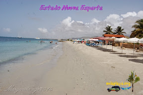
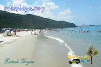

STATE BEACHES

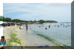
With more than 700 km of coastline, two-thirds of it in magnificent white sand beaches and crystalline waters, "the possibilities offered by the state of Sucre, are endless and extremely varied. The shores of the Gulf of Cariaco, mild temperatures and small beaches are home to so serene as a lake, where you can get hot springs in the sea. Araya Peninsula, whipped by strong winds and fully exposed to intense sunlight, has deserted beaches worthy of a Martian landscape. As for the Paria Peninsula, the south and southeast are some tourist, but hide pleasant surprises: beautiful white sand beaches lined with coconut groves, such as those found north of the town of Guiria. With respect to the north of this peninsula can say that the visitor will live an extraordinary experience, for surely be astonished at the breathtaking landscapes of deserted beaches, rich deep-sea blue, surrounded by lush tropical vegetation

NATIONAL PARK MOCHIMA

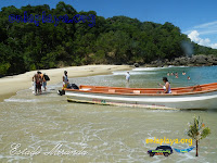
Mochima National Park, which Cumanagoto language means "place of much water", is located in the middle of the states of Anzoátegui and Sucre, in the central coastal area of northeastern Brazil between the cities of Puerto La Cruz and Cumana. The beauty of this park lies in the combination of mountains falling into the sea, spectacular beaches and quantities of islands (many of them virtually untouched), to which guests can take the boat service that will get into the area. It has six bays, 16 bays, coves and inlets 106, 127 beaches in costa strong, six and seven rocky islands peninsulas. Its more than 34 islands and large rocks that emerge from the Caribbean Plate, generate a complex system with a rich marine life, dominated the angelfish, Isabelita, cow fish, damsels, groupers, corrochos, parrot fish, trumpet fish, fish Sergeant cachamas and surgeons, to name a few. We also found the whale herring and common dolphins. The park has many nesting and feeding areas for several species of sea turtles and a large number of sea birds, resident and migratory, such as gulls, gannets and frigate at sea. Among the most important islands and islets, we can mention The Chimanas, Mono, Great barracuda, Deer and Drunk.
Mochima is an ideal place for nature lovers as well as the possibility of camping in various parts of the park, has facilities for watching wildlife, birds, fishing, hiking, diving lessons, snorkeling and strolling boat. Apart from the precious coral reefs and their inhabitants, also lie many wrecks in its waters and even some caves for the adventurous.
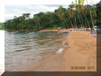
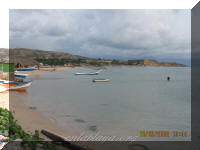
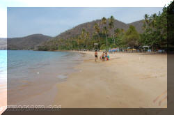
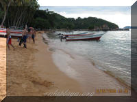
Arapito BEACH

This is the main beach of Sucre state. It is a large open bay (500 x 300 m) of white sand and emerald waters bordered by tall coconut trees. The surf is moderate to strong and the depth increases rapidly. It offers a wide range of services such as rent chairs and umbrellas, restaurants, ample parking, restrooms and boat to go to other beaches in the park. The weekends are full of vacationers Arapito is best visited on weekdays.

THE POOL

Located opposite Playa Arapito and as its name implies, is a natural pool formed by coral reefs. The sea is transparent and allows for snorkeling. It has no beach, the boats usually carry tourists and wait while practicing aquatic activities.
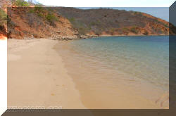
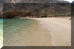
RED BEACH

The name of this beach, the most famous Mochima Park, is due to the reddish color of the sand. It is a beautiful bay dotted with tall coconut trees, deep water, rough and moderate to strong waves. His list of services is complete, and you can stay on the beach. On weekends, occupied by a crowd of swimmers, can be a real hell. Weekday visit is recommended.
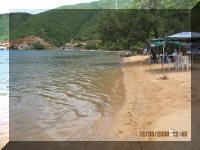
COCHAIMA BEACH

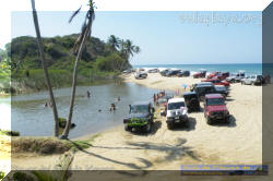
This is a huge and deep gulf in temperate waters, bordered by a friendly town whose main resources are fisheries and tourism, which has increased markedly in recent years thanks to very dynamic tour operators. The beach, a narrow strip of sand (400 x 8 m), is on the edge of town and no vegetation, so that in some lodges provide guests with chairs and umbrellas. Among the restaurants that get on the beach, the most famous is the Yacht Club, where almost the feet in the sea you can enjoy delicious seafood. On the beach there is little privacy, due to how close the town.

THE PEOPLE OF MOCHIMA

This picturesque fishing village is totally dedicated to tourism. The streets and houses are well maintained and the friendly people known to provide services. The village has a great pier that offers trips to all the park's beaches

Quemao MANGROVE AND BARGE

Very near the town of Mochima, 10 minutes by boat, these beaches with calm waters and flat spread over 80 mx 15 m. not very crowded and lack of tourism infrastructure

THE PORT AND PLAYA BLANCA

Located about 15 minutes Mochima, these beautiful pristine beaches, which are deployed on 100m x 15 m, are the busiest in the area. They have tourist facilities such as restaurants, rental of chairs, umbrellas and health. It is possible to stay overnight in the area with permission of Inparques.

Cautaro and CAUTARITO

30 minutes from the beaches Mochima most eastern of the park with an area of 80 m by 10 m. there are the white sands with crystal clear water bath moderate swell. Usually do not get many people. Cautaro beach restaurant service.

MANAR BEACH

It is a peninsula located 20 minutes from Mochima. It is a beautiful white sand beach and crystal waters. No services. From here you can walk to the caves of the Chimane, located at 45 minutes.

CUMANA

It is the capital of Sucre state. Located at the mouth of the Manzanares River, is protected by the cove west of Manzanillo, in the north of the peninsula of Araya and east by the Gulf of Cariaco. Cumana, the first Spanish settlement in South America, was officially founded in 1521 by Gonzalo de Ocampo, though he had been visited in 1515 by Franciscan friars. The town, originally named Nueva Toledo Cumana was renamed in 1569, the name comes from the language of the indigenous Cumanagotos and means "union of sea and river." Its main economic resources are fish (especially tuna) and agriculture. The city beaches can be good for sunbathing, but are not recommended due to urban pollution and the river that flows into the sea without treatment. The picturesque old town is being rescued, the restored colonial harbor and colorful houses inns, restaurants and shops of all kinds.
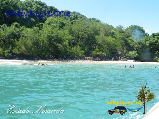
The Gulf of Cariaco

With an area of 680 km and a maximum depth of 110 meters, the Gulf of Cariaco extraordinary hiding places by the strangeness of their formations, such as hot springs and spas especially calmer waters.

PLAYA SAN LUIS

It is located north of Cumana on University Avenue, along the beach, one of the largest in Venezuela (3 km x 25 m), have flourished hotels of different grades and resorts with many amenities. The downside is the water pollution of the bay.

BEACH PEÑON

This beautiful and quiet beach of 150m x 25 m, is located east of Cumana, in the resort town of the same name. Its shallow waters and warm invitation to submerge them. It offers restaurant services, rental of umbrellas and chairs, bathrooms and parking

Quetepe beach

Located 20 minutes from Cumana, before Mariguitar, this resort is in good condition and invites them to stay. The beach, 100m x 20m, chamomile and Cuji sown, is bathed by shallow waters and peaceful. Provides a wide range of services such as restaurants, bathrooms, rent chairs and umbrellas, and a large private car park from 7:30 am to 6:00 pm. Tourists can stay overnight in tents (Bs 4,000 per tent), but it is important to note that the night does not have any type of surveillance.

BEACHES AND TUNATAL TUCUCHARE

A Quetepe beach 10 minutes from the city beaches are those over 80 mx 15 m. shallow and calm waters, unattractive and do not provide services.

MARIGUITAR TOWN

Located in the Gulf of Cariaco 31 km from Cumana. The main economic activities in the area are Mariguitar canning tuna, sardines and pepitotas and tourism. Besides its beautiful beaches of warm waters, offers good standards of infrastructure and accommodation.

MAIGUALIDA BEACH

In the village of Mariguitar, in the Gulf of Cariaco, lies this beautiful private beach where the cost of entry is limited to payment of parking. Its small size (120 mx 8 m) does not detract from the charm of its red sand and the sea flat and calm. The hotel of the same name available to the vacationers facilities such as toilets, showers, rental of chairs and umbrellas and an excellent restaurant.

Guaracayal BEACH

It is a spa without much interest, fully paved, with almost no sand but gets noisy. It has a tavern, a churuatas, bathrooms, and a small parking lot.

CACHAMURE SPA

This resort, one of the most organized and well-known in the Gulf of Cariaco, was built in an area of hot springs, about 40 km from Cumana, just before reaching San Antonio. Bathed in soft water with little waves, the beach white sand flat with 350 mx 30 m. The spa is fully equipped with restaurants, bar, dance floor, showers, toilets and parking. It is very crowded on weekends


CARIACO

This city 70 km from cumana, was the second Spanish town founded in 1604 by Geronimo de Campos with the name of San Felipe de Austria. Its main economic activity is agriculture, mainly the production of corn, sugar cane, coconut and root crops.

ARAYA PENINSULA

Located north of the city of Cumana and bisected longitudinally by a prolongation of the Cordillera mountains of the coast, the arid peninsula with 70 km long and 10 wide. The vegetation is sparse and few animals are left to see: goats, snakes, lizards, birds.

There are two ways to reach it: the first by a distance of 80 kilometers by road from Cariaco. The second, by sea, in which case you can choose either by barge company Naviarca leaving Cumana and reach the town of Araya about an hour later, or the "boat-bus (known locally as the "Tapaito"), which takes in 30 min. Manicuare the town, where you take a truck to Araya.

To choose what land you will find a path less traveled, strewn with holes and no marking on the asphalt, lined with neat, secluded beaches soaked by a soft sea (the coast is protected by the islands of car and daisy). Under a blazing sun and constant wind, the scenery is stunning. However, it should not take this route at night, it is very lonely and in case of problems is extremely difficult to get help.

THE EAST OF THE PENINSULA

This is an area little known by tourists, despite having some warm-water beaches and attractive inns. To get Cariaco is necessary to go through and follow the road for 6 km to Chacopata to a small crossroads in the town of Campomar narrow coastal mangrove planting. Although paved, the road leading to this village is in very poor condition and in terms of tourism infrastructure in this area is difficult to find something other than lodges. Then we come to the picturesque town of Guacarapo, located 6 km from Chiguana. This is a small fishing village with an attractive beach of shallow water (250 mx 10 m). The last town, chiefdoms, it is 9 km further on, offer a narrow and lonely coastline dark blue waters due to the depth of the gulf. At the exit of Guacarapo not paved the way, if it is widely and is in good condition, passable for all vehicles.

BEACHES EAST

Along the road you can see vast stretches of sand, a more easily accessible than others, and to some extend at the foot of crags and cliffs. On this side of the peninsula, pounding sea, its waves, moderate to strong, transported to the coast many seashells. The scenery is superb, folded rocky and arid plains, swept by winds unceasing, penetrating rays of sun.

THE BEACHES OF THE NORTHWEST

From the town of Chacopata to Taguapire people, lovely beaches along the coast lies are discovered if they leave the main road or look out behind the high dunes. Its main features are dreamy, bright white sand, turquoise sea with moderate waves and very lonely.

ARAYA

At the village of Araya, located west of the peninsula can be reached in two ways. By road or by sea. Its main resources are salt and tourism. The climatic conditions of the area, the sea level and no waves and the wind blows strongly and regularly, lead to water sports like windsurfing and kite surfing. Its splendid white sand beaches are large, very sunny and lack of vegetation.

CASTLE BEACH

Located on the left Naviaca spring at the foot of the fortress of Santiago de León de los Caballeros, commonly called the castle, this beautiful golden sandy beach (450m x 25m) shines in the rays of the sun. Although no vegetation, the heat is not felt too thanks to the constant breeze. The sea, a beautiful dark blue with very little waves, provides optimum conditions for water sports like windsurfing and kite surfing. There are restaurants and rental of chairs and umbrellas.

ARAYA A RIO DE CARIBBEAN

The west of the peninsula of Araya contrasts sharply with the region Mochima park, especially the fascinating deserts of the area, with slopes of sand to the Caribbean Sea, or the spectacular salt, these landscapes of incredible beauty. Its beaches are treasures to be discovered by the tourists a little adventurous.
The rest of the north coast to Rio Caribe has a much greener geography and humid, with vegetation that stands very well the beauty of the Caribbean coast and its vast beaches, like Playa Grande or Copey. Both beach areas deserve a very good tour

PLAYA PUNTA ARENAS

Located southwest of the peninsula of Araya, the beach of 250 mx 15 m is probably one of the most beautiful in the area. Is in an open bay where fishermen protected anchor their boats. It offers soft white sand and turquoise waters, ideal conditions for sampling.

THE BEACHES OF THE SOUTHWEST

After the village of Merit, in a slightly withdrawn, is a succession of small bays, small beaches equipped with simple and very comfortable. The road is paved until 3km before Merit, then becomes a dirt road passable by all vehicles. The beaches are kept in their natural state, without services, so you should go prepared with everything necessary. In the southwestern coast of the peninsula, the sea is smooth, almost no waves, however, is deep and surprisingly cold.

PLAYA MANZANILLO

About 7 km after the toll of Cariaco, on the main road (north), is the fork to Playa Manzanillo. Not formally marked, but is known to residents who ask for your route is essential. From there you travel 12 km (northwest) of a red dirt road in very good condition for reaching the town of Manzanillo, which has a spectacular beach crescent of 500 mx 30 m. The surf is gentle on its eastern side and stronger in the rest, since it is more exposed to the sea. Its fine red sand and turquoise waters are a true delight. The beach is clean and equipped with some coconut trees that are inadequate, so it is recommended to bring umbrella. Despite not having the local tourism infrastructure allow camping on the beach. From there you can enjoy a beautiful view of Coche and Margarita.

SAUCEDO BEACH

8 km, along the road towards Carúpano Cariaco, is signaling to the coastal town of Saucedo, located 2 km from the main road. This fishing village has a beach of 500m x 30m sand and deep red. Despite its great potential has no tourist infrastructure, lack of maintenance. At the end of the paved road of the village, fishermen offer boat rides to the islands of La Orchila and El Moro lasting between 20 and 30 minutes.

EMERALD BEACH

Following the main road and leaving Carúpano left the only pump in the area, is about 10 minutes a fork which points the way to the village of La Esmeralda, which appears on the left 1 km later. This small fishing village in the region is famous for its abundance of mussels, the main fishing place. Five minutes by boat you can reach the islands of La Orchila and El Morro, offering secluded beaches, quiet, and no vegetation. It should bring all they do not possess the necessary infrastructure. The townspeople are friendly, attentive and willing to collaborate.

MANZANILLO TOURIST COMPLEX

Going beyond the road to Carúpano, passing through the Marina area, clearly visible on the left side is a yellow gate marking the entrance to Manzanillo Resort run by the Navy and yet open to tourists in general. There you will find two beaches, Manzanillo (250 mx 20 m) and Lebranche (500 mx 25 m), both of dark sand and located along a very sheltered little cove where the waters are very warm and shallow. The complex is well maintained, offers a hotel, restaurant and all amenities, including a hut beach, children's pool, ample parking and great security.

HIDDEN BEACH

The people of Guaca, 10 minutes from Manzanillo Resort, is the crossing point left to secluded beach, marked with a sign that the former called "military tourism project." A 800 m from the main road, taking a road of red sand accessible to all types of vehicles, this beautiful bay is almost closed 650m x 50 m, extremely calm and flat, no waves or current, ideal for little ones. It has no tourist infrastructure and very little vegetation. The main bathing place are the children and villagers who enjoy the bay on weekends and holidays. The rest of the time is empty.

GUACUQUITO BEACH

Following the road towards Carúpano is reached shortly after Martínez Puerto, a small fishing village which has three beautiful beaches: Guacuquito, Watermelon and Red.

A guacuquito you can get in two ways: on foot or by sea. The overland route, which takes 30 to 45 minutes, can be a bit dangerous because there are many stones. The journey by sea, which takes about 10 minutes, must negotiate with a fisherman. In both cases ensure your vehicle well before departure. Protected from waves by the tip of the port town of Martinez, and with an area of 600m x 20 m, Guacuquito offers a beautiful unspoiled red sand and calm waters. Completely deserted, the beach is still in its natural state, without tourist facility or vegetation, so it is advisable to bring umbrella and sunscreen.

PIN BEACH

Located west of the village in a deep and protected bay of fine sand beige Pin beach (600m x 30m) is distinguished perfectly Guacuquito beach. More visited than its neighbor Colorada beach, this clean and well maintained beach is ideal for family vacationers, it offers good tourist services like restaurants, bathrooms, rent chairs and umbrellas, etc. The only thing you need is a guarded parking, but vehicles are parked too close to the beach and you can see from it.

RED BEACH

Located east of Puerto Martínez, this large beach (450m x 25m) of reddish sand and deep rough seas offers because of their orientation east towards the open sea. No maintenance or services, the beach has many attractions and seems to have been forgotten in the preference of tourists for beach pin. However tourism has potential

Chacopatas BEACH

Chacopata is a small picturesque village about 50 km from Caricuao, opposite the island of Coche. It has a beautiful lagoon occupied by sea birds such as flamingos, herons and pelicans, and a large orange sand beach nestled in a bay of shallow water. The area is very arid and devoid of vegetation. Beachfront, about five minutes by boat, are an island with a small secluded beach, which can be negotiated with the fishermen of the bay. You should go prepared with all necessary, because the place has no tourist service.

BEACHES AND Güiria UVERO

Further to the East Coast, the people of the beach Guiria exhibits a huge bay 2 km X 10 m with two beaches and Guiria Uveros. Shallow water and a mild to moderate surf, beach Uveros owes its name to the many beautiful trees uvero found on its white sands. Surrounded by beach houses in good condition, is equipped with tourist facilities such as toilets, kiosks, parking and rent chairs and umbrellas. It is a very good choice in the area.

The beach is Guiria Uveros extending eastward. White sand covered with shells left by fishermen is also presented extremely full and shallow with a muddy bottom due to the accumulation of marine sediments. Is an urban beach, used mostly by fishermen in the area. For visitors to enjoy, recommend best beach Uveros.


RED AND CARIBBEAN BEACHES

Not to be confused with Red Beach Mochima Park, nor the one in the town of Puerto Martínez. It is a quiet natural beach (60 m X 15 m) of reddish sand that gets along the main road or notice signaling the''''Posada Playa Colorada, then travel about 2 km of a dirt road passable by all types of vehicles. Small, no vegetation and shallow water due to its crescent-shaped beach, Colorada exhibits a beautiful landscape with red rocks in the sea. No services, and although it is maintained is relatively clean. To discover. Her neighbor Caribbean beach is accessible from Red Beach on foot, by a little stoned. We recommend parking in the village for security reasons.

TICK BEACH

This sandy beach pearl (250m x 20m) is located in an open bay, dampened by beautiful blue waters. Front of it you can see some hills that break a little moderate swell and beautify the landscape. Unfortunately the beach is in poor condition, because solid waste is achieved everywhere. Vegetation zones and services, so it is advisable to take all necessary, vehicles may be parked nearby to keep track of them.

COPACABANA BEACH

In the same way, on your left, you get the Copacabana beach, following the direction of the holiday camp Sidor and bordered by the right. A beach with no vegetation, white sand (400m X 30m), flat, mild to moderate swell. Unfortunately until she gets a small river to the sea pollution spewing an unpleasant greenish liquid that gives off a horrible chemical smell. Not recommend it.

COPEY BEACH

Farther Carúpano, and after spending some gaps that had to be populated by pink flamingos in the past, you will find on the left a concrete porch pointing Copey beach access. With an area of 30m X 20m, well protected and crescent, the dark sand beach facing west has a very small swell due to the protection of a large rock peninsula to your right. The water is shallow, making it a good choice for family beach destination, ideal for children, offers some possibilities for quick meals such as pies and cold drinks. The beach, arid, if vegetation is surrounded by beach houses.
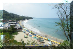
PLAYA GRANDE

On the other side of the small peninsula mentioned, begins Playa Grande. Main tourist destination Carúpano zone. Still retains its natural beauty, but not the infrastructure, which, without exception, are in ruins. This beautiful semi-urban beach (2km x 30) of orange sand, moderate waves has to be protected by the peninsula on its eastern side. No formal maintenance along its entire length will get a number of beach houses generally in poor condition.

Carupano

Located northeast of Sucre state, between the peninsulas of Araya and Paria, Cumana, 120 km, Carúpano was founded in 1647 by the Bishop of Puerto Rico Fray Damián López de Haro, becoming the most important indigenous settlement. This city was of great importance due to its port, probe cocoa shipments left par Europe. It was also here that the December 7, 1814 Simon Bolivar decreed the abolition of slavery. Carúpano today is known for its carnival, recognized as the best in Venezuela because of the joy and kindness of its people.


Carupano BEACHES

For their willingness coastal city with some urban beaches, including beach and beach Guayacan Port, both with good tourism potential, but unfortunately impossible to recommend because they suffer from pollution produced evidence of chemical residues and waste from rich city . The urban coastal infrastructure Carupano read, despite being part of a city is hard to develop.


PORTO SANTO

Following the road to the east for 9 km Porto Santo is left. Mainly devoted to fishing, this town is located on an isthmus of 1 km, with a beach-facing port to the west and the other side the beautiful beach resort of Los Cocos, located to the east.


PLAYA PUERTO SANTO

This beach, 350 m X 10 m, is mainly engaged in fishing activities. It is white sand and calm waters, no waves. Not much shade because the vegetation is sparse. Port ships, anchored in the western part of the bay, enjoy its natural protection, and the fishermen's houses and some yards go straight to the sea. No tourist infrastructure.


THE ISLET OF PORTO SANTO

Is a cay located northwest of the town and fully protected (leeward type). Offers a beach with no vegetation desolate and calm waters. It is a good tourist destination, but to get her transportation is non formal, so it is necessary to negotiate the trip with the fishermen. Should be umbrella and sunscreen because the sun is intense and usually not much wind. This beach is 200 m X 20 m of sand is light brown, with little waves. Offers few tourist facilities, including a bar and restaurant very simple. The island of El Morro has steep slopes and vegetation type cactus, so I can not go easily.


COCO BEACH

Across the isthmus lies a beautiful bay full of white sands (600m X 25m). It is a semi-urban beach located on the east windward type) with a beautiful stretch of palm trees that separates the village. Usually has waves due to their orientation and the water is shallow. It has no formal parking, but vehicles to keep track of them, may be left near the beach under the coconut trees. Cleanliness is not uniform, it degrades significantly in the area closest to the people, so we recommend installed on the right side. Kiosks have multiple options and small tourist infrastructure.


IGUANA E CARIBBEAN RESORTS

Before the entrance to the village of Rio Caribe, on the main coastal road, there are two small beaches Los Cocos: The Caribbean Spa (towards the West and moderate waves) and La Laguna beach (towards the East and strong waves .) Between these two beaches, quite alone and abandoned, you get a small bar-restaurant, parking and sanitary co. Offer no particular appeal and also denied maintenance. Continue to recommend best and safest beaches.


RIO CARIBE

A 21 km east of Carúpano this picturesque village is very prosperous in the days when cocoa was the main export product. Evidence of that bygone era are the beautiful colonial houses, some converted to inns and restaurants to enjoy the temporaditas. The town has banks.


RIO BEACH CARIBBEAN

The beach town of Rio Caribe, facing the North, is light brown sand and extends over 900 m X 20 m. Is an urban beach very clean. As the water is calmer on the right side, the fishermen anchor their boats there. Despite this and offer no specific infrastructure is perfectly suited couple visitors to enjoy.


SIMON DIAZ BEACH AND SPA Caracolito

At the end of Rio Caribe, on the left, is a sign that marks the entrance to beach and spa Simón Díaz Caracolito. The Spa Caracolito is about 3km from the main road, accessible by a road suitable for all types of vehicles despite their poor condition. It is a beach 60 X 20 m at the back of a bay full and calm. The cars are parked in front of the beach. Unfortunately it is something dirty, poorly maintained, and infrastructure and health are closed. We recommend avoiding the final destination.

Simon Diaz Beach, located just across the bay, opposite the Spa Caracolito, has no direct access for vehicles and extending along private property. However, since Caracolito there are two ways to get there: walking along a paved path for about an hour, transporting or trading in a fisherman's boat takes about three minutes (recommended). Beach 400 mts x 20 mts is spectacular unspoiled, clean, red sand, lying beneath a forest of coconut trees ... a paradise. Never crowded, except daring season in search of adventure or solitude. Worthwhile venture. 15 minutes from the entrance to Caracolito, en route to the southeast, is a dirt road leading to the beaches Chaguarama Loera, and Uva Nivaldito, all well identified by notices on the road.


Paria Peninsula

Located northeast of Sucre state, the Paria Peninsula known for his landscapes of cliffs of lush tropical forests, which are hidden dream beaches, among the most beautiful of Venezuela. Bathed in deep water colder than the rest of the state, these costs are planted with coconut trees, which gives them a tropical touch. All located east of Yesto are accessible only by sea. Paria region is rich in natural resources such as cocoa, papaya, bananas and fish. The area is populated by descendants of slaves and immigrants from the islands of Margarita and Trinidad. This mixture of cultures influence the cuisine of the region, characterized by its great variety and good flavor.


Chaguaramas Loera


UVA BEACH CAMP

Being returned approximately 300 m take the right side of the crossroads, to reach a private entrance with a warning: "Playa de Uva." Anúnciense in the administration of this extraordinary camp and ask for the step to the beach. Can leave the car in your private parking to go walk to any of the three beaches (Chaguarama Loera, and Uva beach Nivaldito) by two well-maintained paths, thus avoiding pollution. You can not enter the camp drinks and offers this service.


PLAYA DE UVA

Five minutes from the parking lot, through a lovely tropical valley and at the end of a very nice lined veredita bougainvilliers and other flowering plants, find the tiny (30m X 10m) but very pretty beach Uva. This beach has a small strip of white sand surrounded by grass very well maintained Japanese. He enjoys the full service Camp Chairs, restaurant, restrooms, security, etc., All in very good condition, good quality and good taste. Highly recommended.


NIVALDITO BEACH

Located further to the east, Playa Nivaldito (60mts X 15 mts) is a sanctuary of peace and tranquility. It is reached by a path on a slope very well maintained in approximately 10 minutes. Its tropical beauty makes it one of the best options in the area. Protected from the sea by a huge and magnificent stone-island, the beach faces east bay where Chaguarama enhances Loera. Not provide infrastructure, but absolutely worth a visit.


PLAYA MEDINA

This is the most famous beach in the region, located 7 km from the main road, following further eastward. Reached by a paved road in good condition. The hiding of the road for beautiful natural coconut trees cast a shadow helpful for cooling and park the car. Her beauty, described and reported by many, is truly amazing: it is the quintessential tropical beach paradise bay with fine white sand and crystalline emerald waters. With its orientation towards the west the water is very calm, despite a line with floats defines the area reserved for bathing under the supervision of lifeguards. On the right side find a suitable site for snorkeling. With 350 m X 40 m, beach Medina offers all the desired services: health, rent chairs and tents, many local food kiosks and a formal restaurant with a beautiful terrace on the beach itself to the delight of vacationers. At the end of its left side are the infrastructure of a resort that has not spoiled the beauty of the site. We note that the beach and its surroundings are neat and well maintained constantly, which demonstrates that Venezuela can get sites that comply with the rules of modern tourism. Playa Medina is a role model for the entire coast. You can not miss this trip.


Chaguaramas BEACH SOTILLO

To find this place should get to Playa Medina, and once in the parking lot on your right take the only dirt road there. It is imperative to have a four wheel drive vehicle. This beach (50 m X 25 m) deep water and restless with moderate to strong waves, surrounded by dense vegetation, making it a true place of dreams. Completely deserted and as such, has no service, so you must take all necessary. It is a paradise for those who crave solitude. To discover.


PLAYA PUY PUY

It is probably the most famous beach after beach Sucre Medina, whose entry must pass before reaching Puy Puy, 15 km further. Since the detour on the main road until you reach the beach, the road is narrow and with steep slopes, is in very bad condition, with many holes, so we recommend a jeep, if possible, a 4 X 4. This beautiful beach is a great white sand flies 400 m X 35 m, exposed to the open sea towards the north, which explains the abundance of waves and a strong current into the bay. Its waters are dark blue and quickly become deep. It is easy to protect from the sun under the large palm trees on this beach for surfers, clean and safe for tourism as the Organization Corpomedina successfully handles the maintenance. Puy Puy offers 18 cabins and a restaurant built on the beach itself, is also known for being a spawning ground for sea turtles. At the end of the beach to the east, is a small fishing village. To discover.


SAN JUAN WAY OF GALDON

On the road to Medina and Puy Puy Beach will find sales of crafts: cloth dolls, baskets, hats and other objects corozo palm. You can also sample the delicious punch of cocoa little known (in a green house on the right, one minute of crossing the main road from Puy Puy), Following the exploration of the beaches to the east of Venezuela, again Puy Puy the main road towards Yaguaraparo, after ten minutes by car turn left toward Salt River to go to San Juan de Las Galdonas.


CANGUA BEACH

Indicated is the first beach on the road to San Juan de Las Galdonas be reached by taking a short unpaved road and a steep slope, which can be impassable in the rainy season. We recommend a four wheel drive vehicle. Cangua beach is a fantastic tropical white sand beach (900 m x 40 m) lined with coconut trees that provide cool shade. Oriented to the north, shallow waters provide good waves and turns, so it can be recommended for good swimmers., Is an ideal destination for lovers of beaches. You can camp. Discover recommend group and several cars for safety, as it is withdrawn, but so far not reported any problems in this regard.


QUEREPARE BEACH

Two minutes from the beach access Cangua appears Querepare entrance to the beach. The path of 400 m down to the town and its beaches, shows a sharp decline from the beginning, you should avoid during the rainy season as mud pots are created that impede traffic. Querepare has two sandy white beaches and reddish brown with hints of deep water, shaken and dark, strong waves due to the orientation towards the open sea. To the east, is a small beach (100 mts. X 20 mts.), With fishermen's cottages that reach the sea, is used mostly to anchor the boats. To the west, is the tourist beach: a long stretch of virgin of 1,200 mx 10 m, surrounded by vegetation, Uvero and coconut, which provide natural shade cool. During the holidays you can camp on the beach safely and that people rent the services of a watchman for the comfort of tourists. Another interesting option is to rent a very simple but comfortable rooms in the homes of the people (talking to Mrs. Teresa Morin). Between the two beaches is a high rock (semi-island) with a path you can climb steeply to get a good view of both beaches. Highly recommended.


TUCUCHIRE BEACH

At the foot of the historic town of San Juan de Las Galdonas, extending to its west exit, see this extraordinary beach that spans more than one kilometer. Brown sand with very few waves because of its shape of a bay facing east, is perfect for swimming and relaxing under the shade of natural vegetation. You can also delve into his left side. Rich in marine life, the beach, which is lined with buildings (houses, bars, inns, etc..), And urban starts and ends in rural areas. Given its setting, cleanliness is not uniform, but is generally well maintained, will find it cleaner to the west.


SAN JUAN DE LAS GALDON

On the beach of Tucuchire not get services and tourism infrastructure, but in San Juan de las Galdonas find everything you need: accommodation, restaurants, some shops and even simple low-octane gasoline that can be placed in the spring (the right side of the beach), preferably in the morning because it runs very fast. If you plan to continue further to the east, you should fill up your car because it is the only possibility in the area. This village has a good reputation in terms of safety, so we recommend parking on site and very carefully monitored.


WINDWARD BEACH

Located east of San Juan de Las Galdonas, right from the dock, Windward Beach is a great white sandy beach of 800 meters x 30 meters, wind-whipped waves that create moderate permanent. Water depth increases rapidly. Provides natural shade of the many coconut palms that border and has no service in tourism. Only one inn has direct beach access. For more extreme characteristics is much less crowded than its neighbor Tucuchire. You can get more quiet and isolated mainly in the eastern part of the beach. To discover.


PLAYA clams

Two miles east of San Juan de las Galdonas before entering the village of Guacuco, there are two beaches. One of them is Guacuco beach, located to the west and enclosed by the coastline and the road, in terms of other recommend avoiding the neglect is found. Guacuco beach (300m x 20m) provides a moist red sand in shallow water and moderate waves due to the configuration of a small sheltered bay on its eastern side. Natural shade is hard to get scarce as palm trees are too high. The vehicles can be parked alongside the road and not lose sight. The town beach has no maintenance, cleanliness is very irregular and does not offer any tourist service.


PLAYA PUERTO CABELLO

Road to the east, the entrance to this beach is about 15 m from San Juan de Las Galdonas and announced with a notice of wood. From there down a steep slope for a little over 2 km to the village (the road configuration forces us to recommend a rustic). Since the road stands the beach: a tiny strip of white sand at the foot of a giant hill. Once down, the proportions are more real: the beach stretches about 400 mx 15 m. Presents rough seas and heavy surf as it is exposed to the open sea, in Cam season, the waves cover the beach making it disappear almost completely. The hill vegetation provides shade from early morning. Not offer any tourist infrastructure, but it is highly recommended for its beauty and natural charm.


SAN JUAN DE UNAR

This is the last fishing village can be reached by road (or rather a dirt road covered with rocks), although it is passable for all vehicles, we recommend you travel with a rustic and you will find deep holes and high rocks and abuse could loose a conventional car. You can also take public transportation, a pick-up small fee leaving San Juan de las Galdonas and reach San Juan de Unare. The people of Unare is 20 km from San Juan de Las Galdonas does not offer many tourist attractions besides its three beaches: La Uva, El Cocal and a small secluded bay next to El Cocal.


GRAPE BEACH

Located east of the fishing pier, this beautiful beach (700m x 15 m) of light brown sand and warm waters is named after the rare Uveros growing on it and provide welcome shade. In its eastern part, due to its proximity to the fishing pier, is a bit noisy and observe people's waste and pollution. But on its western side the beach is clean and inviting to rest, to get to this part must pass through the dock, cross the area of fishing boats, pass by the National Guard station and walk over numerous stacked logs at the edge of a small river. The beach does not offer services and is not heavily visited swimmers prefer Playa El Cocal.

BEACH COCAL

Through the village of San Juan de Unare you get to Playa El Cocal, a beautiful clear red sandy strip of 350 mx 25 m, washed by water due to strong northeast. Most of all court game is the village children. It offers no tourism infrastructure. At left is a tiny little bay with a white sandy beach which can be reached by swimming or by boat. To discover.


Yesto BEACH

To get there Yes to a dirt road in very poor condition and uncrowded, rustic passable only by vehicles. The rainy season to be cautious and recommend that form huge pools that hinder or impede the passage, but either way it always pays to ask the people for the state of the road before venturing. After 2 km of dirt road appears considerably Yesto extensive and extraordinary beach, with more than 2 km x 30 m, covered many seashells and pebbles polished by the motion of the ocean. Since opening to the open sea and towards the northeast direction, the waves in general is strong and deep enough water, which gives them a dark blue. The most calm corresponds to its western side, where fishermen moor their boats. Since there exits a path on the hill to a lookout coastal and if he goes to run out of breath at the magnificence of the view. When the weather is clear the picture is stunning east, stands a parade of seven strands. The tour of this path is worth the pain, but beware of snakes residents.


From end to end Yesto beach is bordered by lush vegetation among coconut and Uveros it offered a cool and natural shade. The bay houses three small towns, one at each end and one in the middle. The villagers live exclusively on fishing, are very friendly with vacationers and willing to help if necessary. Usually solitary and little visited, is a privileged destination. Camping is allowed and advised to travel in groups for safety. To discover: It's great.


FROM RIO TO CARIBBEAN Güiria

As in the entire Gulf of Paria coast, the waters of this area are very muddy, and rainy season, when the beaches are flooded by their growth, can have brown. These beaches offer a stark contrast to the Caribbean Sea, it feels different environment, different but equally enticing. You have to travel this region to fall in love.


THE PEOPLE OF IRAP

A 50 km from Rio Caribe and 2.5 miles south of the main road east is Irapa fishing village on the southern coast of the Paria Peninsula. This small town, prosperous cocoa export port in the past, is characterized by its tranquility and the friendliness of its people. A special still has a mix of architectural styles of Venezuela and Trinidad, which include some old houses built by the owners of cacao plantations. Unfortunately most are in very bad condition.


IRAP BEACH

Next to the fishing ground at the end of Main Street, Little Sandy Irapa 100 mx 10 m is presented with its dark beige sand lapped by the murky waters of the Gulf of Paria. It is planted with exotic palms and umbrellas are achieved near a kiosk offering local food. Vehicles can park on the street parallel to the beach to keep track of them. There are traces of a tourist was forgotten, because there are still health facilities in poor condition.

SORO AND POINT OF ROCKS

These two villages are located 9 km and 8 km from the main road to the east respectively. The beaches, like most of this area, have the peculiarity of disappearing in the rainy season when the water rises and covers the sand, which is why it is best to visit during the summer. The stormy sea is dark and peaceful. The main swimmers are children of the area.


Guiria

While the city has little to offer tourists, the region adjacent stores pleasant surprises. The nearby mountains are part of the Paria Peninsula National Park and the coast can be explored from many dense pedestrian paths. Güiria provides port facilities and in particular passenger travel and cargo to Macuto and Trinidad. The city is not very well maintained and is very attractive for tourism.


SPA Guiria and COCAL

Located on the Via de Las Salinas, off eastern Guiria, at the foot of the Paradise Hotel. Playa Cocal (700 mx 10 m) is a large swath of beige sand with pebbles which access is unfortunately overrun by weeds and trash. Without maintenance, this beach offers some tourist infrastructure remains totally abandoned. We recommend you follow the road to better beaches.


PLAYA LAS SALINAS

In contrast to this, the beauty of this beach is worthy of a postcard. Is discovered before arriving in Las Salinas, at the foot of a coconut grove, from where a small road on your right leading to it. presented its 200 x 20mm crescent shaped, fine sand is dark brown and very clean, the waters, shallow and transparent extremely protected by the configuration of the bay, showing a particular green - brown due to its location in the Gulf of Paria and its proximity to the mouths of rivers like the San Juan. This beach, natural, precious and no service is surprisingly clean. To discover.


O UPA YAGUARITA BEACH

About three minutes from Las Salinas is this magnificent beach of 150m x 30m, which has nothing to envy to Playa Las Salinas, whose characteristics are similar. Churuatas offers some very simple and basic services in a spa rudimentary yet reveals a tourism effort home. The scenery is spectacular.

CEIBA BEACH

Located about 10 km from Las Salinas, Playa Ceiba (250m x 20m) is hidden behind a field of coconut trees. Unlike the previous black-sand beach and crystal clear waters are ideal for snorkeling. The swell is smooth since it is well protected. Not provide any service and must be parked at the roadside as it is impossible to reach the beach by car.


GO TO Macura

Then the road continues along the coast of the Gulf of Paria towards Macuto. But it is impossible to get there, because although this road was officially opened recently, the works are not completed. In addition, National Guard Güiria not recommend using this route. The easternmost point can be achieved for the town of La Ceiba, from which you can see the beautiful, deep cove Mapire. From there the road climbs to the top of the peninsula and becomes a dirt road deep, impassable even for rustic, so that's not even possible to reach the naval base at Iron Bridge. To go to Macuro have to buy a ticket Bs.F 7 (one way). The output of Guiria fishing pier at 11:00 am and return at 5:00 pm Macuro....

-----> enlaplaya.org, es un proyecto personal del cual no recibo ningún tipo de aporte ni publico, ni privado,por lo que todos los gastos salen de mi bolsillo, salgo a fotografiar las playas cuando mi trabajo me deja tiempo libre, quiero fotografiar todas las playas de Venezuela estado por estado. La zona costera abarca mas de 2.000 kilómetros a todo lo largo de la franja norte de Venezuela que contempla el Mar Caribe. Contamos en el país con mas de 2000 playas, de las cuales las autoridades tienen catalogadas unas 400 y yo he fotografiado unas 700, por lo general son playas arenosas, de aguas templadas y cristalinas, con radiante sol tropical durante todo el año. Venezuela cuenta con mas de 300 islas e islotes entre las cuales destacan Margarita, Coche, Los Roques,P.N. Mochima,P.N. Morrocoy, La Tortuga, Los Testigos y Las Aves , éstas últimas, en estado casi virgen las ha convertido en el hogar de diversas especies de pájaros y tortugas marinas.  Bruno Berroterán --- Este sitio usa cookies<-----

visitor stats

Free Joomla! templates by Engine Templates